THE CROSSING
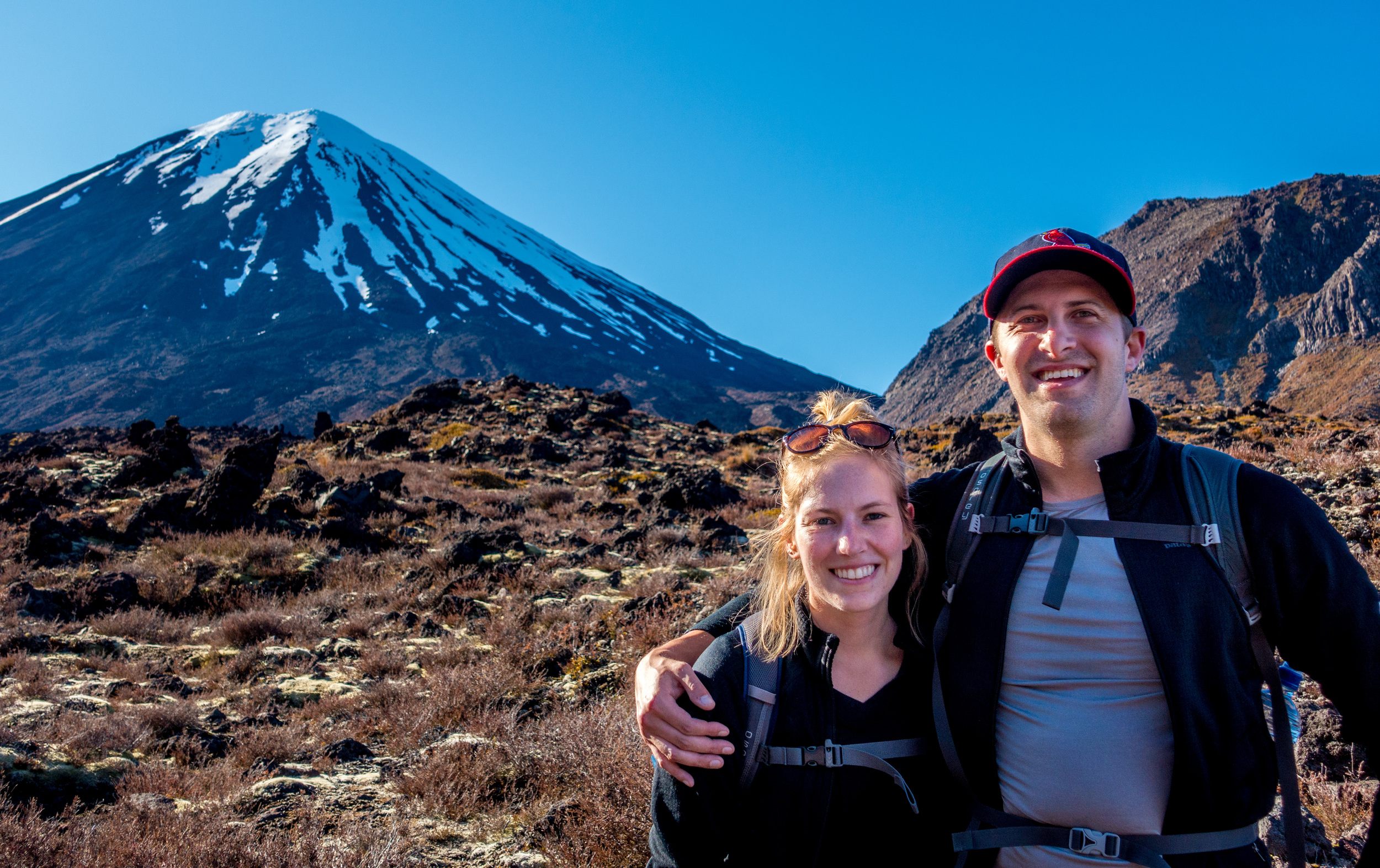
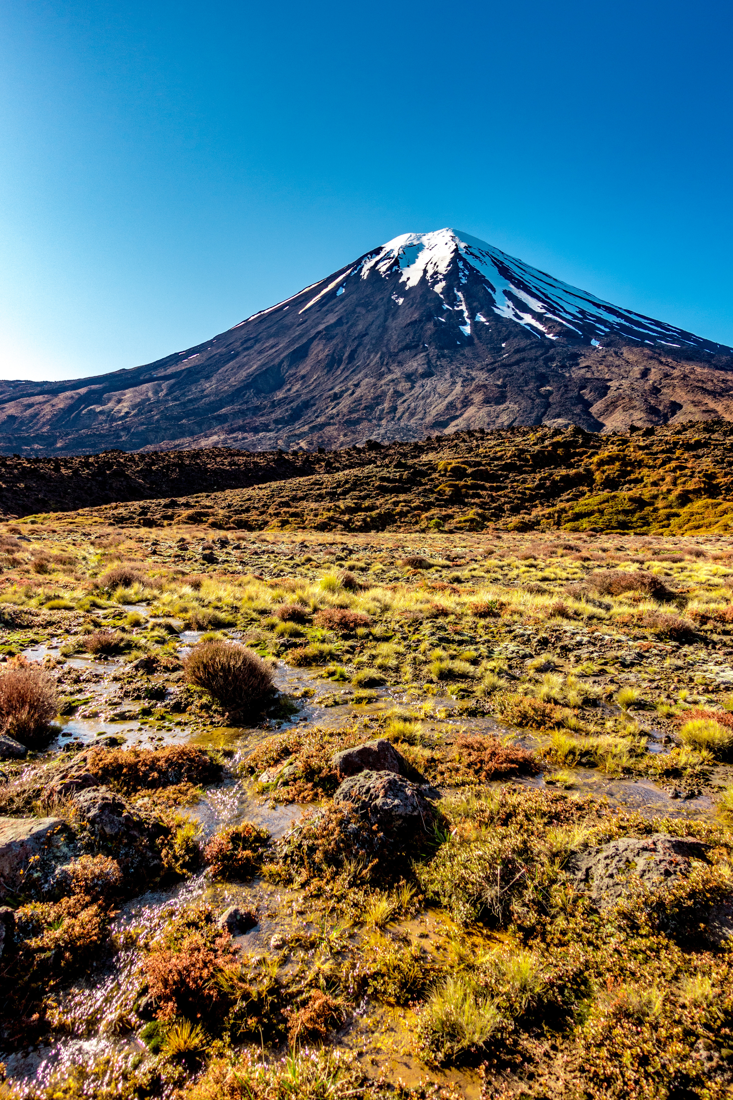
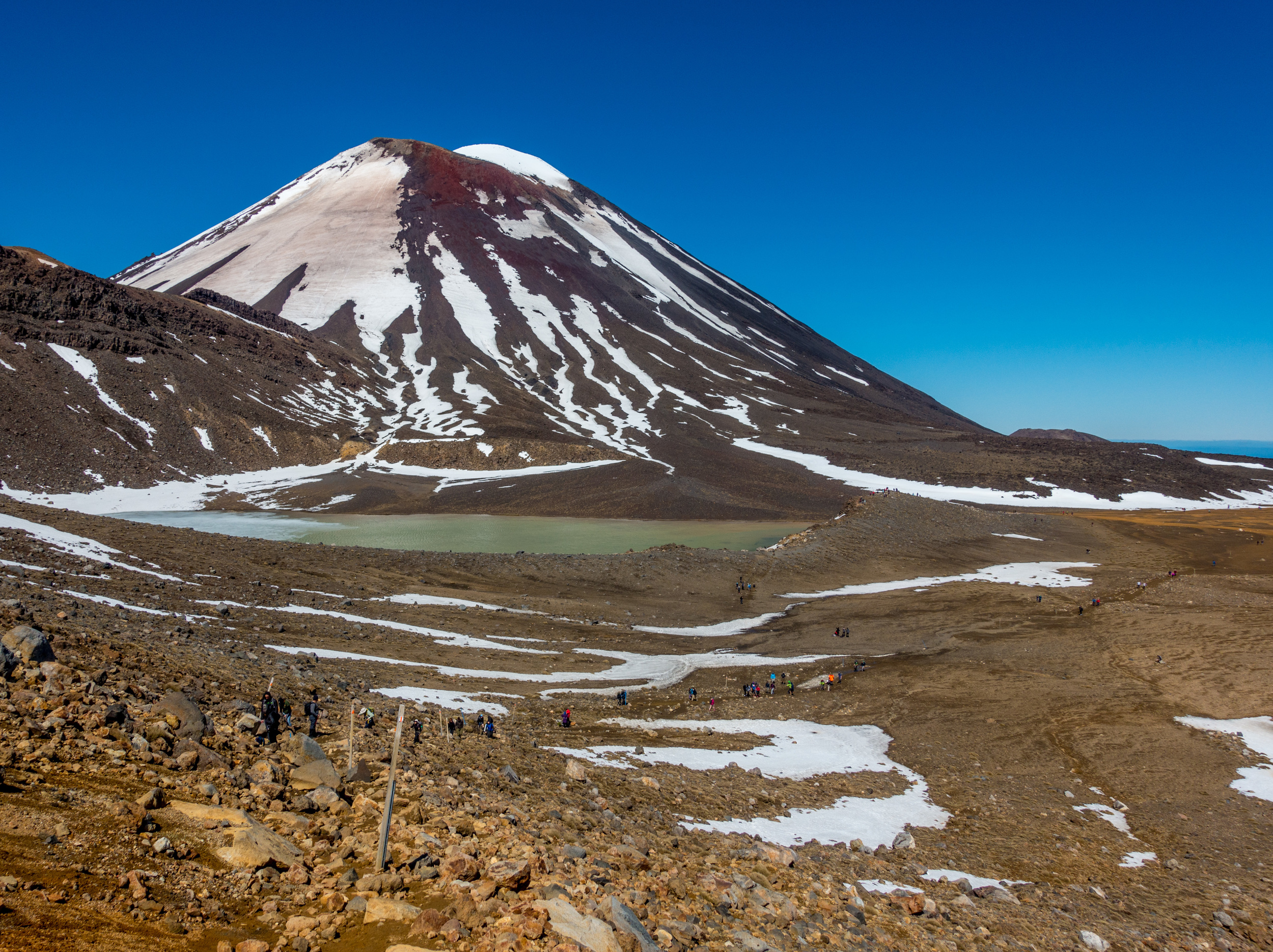
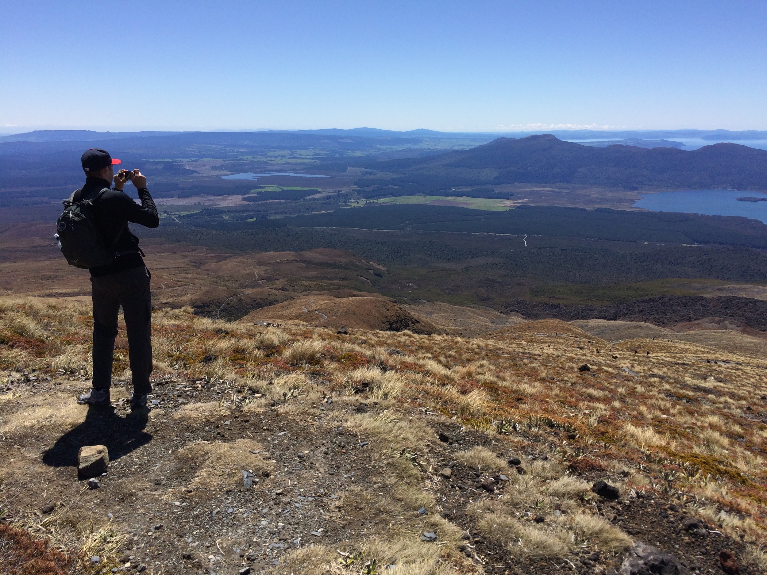
I did question my sanity at times. The 12.1 mile (19.4km) hike turned out to be quite the test of endurance, but the hike turns into a story of triumph once you're standing at 6,000 ft with 360 degree views of Northern New Zealand. It is tiring, exhilarating, overwhelming and just plain awesome. And an added bonus - the perfectly shaped Mt. Ngauruhoe serves as the model for Mt. Doom in The Lord of the Rings.
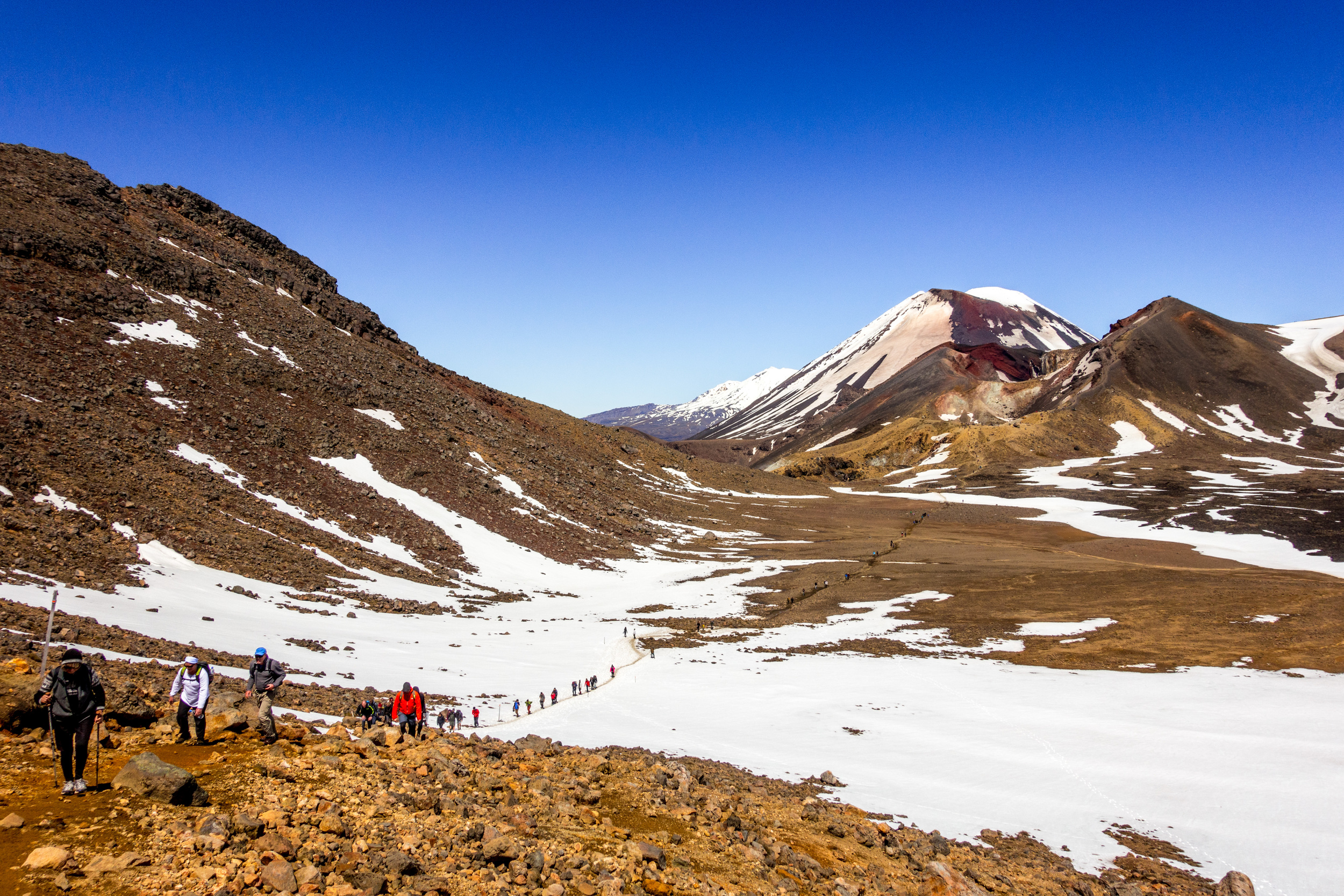
The Tongariro Alpine Crossing is the day hike version of the Tongariro Northern Circuit, one of New Zealand's Great Walks. We hit the track right at 8am and it took us 7 hours and 10 minutes to reach the end. We were lucky enough to have no rain, but even on a day with the best weather (as we had) there is no shade, a lot of wind, and snow covering parts of the trail. We were told that the weekend we hiked was actually the first week of "the season" for this hike. Nice weather and a public holiday weekend meant many Kiwis were hiking The Crossing with us - even a couple people carrying their babies on their backs!
As a beginner hiker with asthma, I was a bit hesitant about this hike. It was definitely a challenge, both physically and mentally, but a challenge worth doing. If you're not sure about doing it - just go for it! Hiking in the late Spring or Summer months means there will be plenty of other people on the trail to help you if you are in need. Just prepare to have sore muscles for almost a week. :)
WHAT YOU DEFINITELY NEED TO BRING
- At least 1L of water per person, 1.5-2 per person if able to carry
- Something to cover your ears/face from wind and sun
- Hiking shoes or boots
- Wind and water resistant jacket, that can easily be packed away when at lower altitude
- Layers of shirts and sweaters
- Plenty of snacks
- Sunscreen
- A hat and sunglasses - starting early in the morning means you'll be walking directly toward the rising sun for a few hours
Optional: hiking poles - About 50% of the people on the track had them. We managed without, but probably would have had an easier time with them.
You must also book a shuttle to the beginning of the track - you leave your car at the end so it is there when you finish. There are plenty of services that will shuttle you to Mangatepopo, unfortunately we do NOT recommend the one we chose: Mountain Shuttle. We booked the shuttle with promises of a security guarded carpark and hiking poles. We only got the ride and were insulted by our shuttle driver when we suggested we were not getting what we paid for. Do yourself a favor and don't make the same mistake we did by using this particular service.
STAGES OF THE CROSSING
Part 1: Mangatepopo Valley to Devil's Staircase
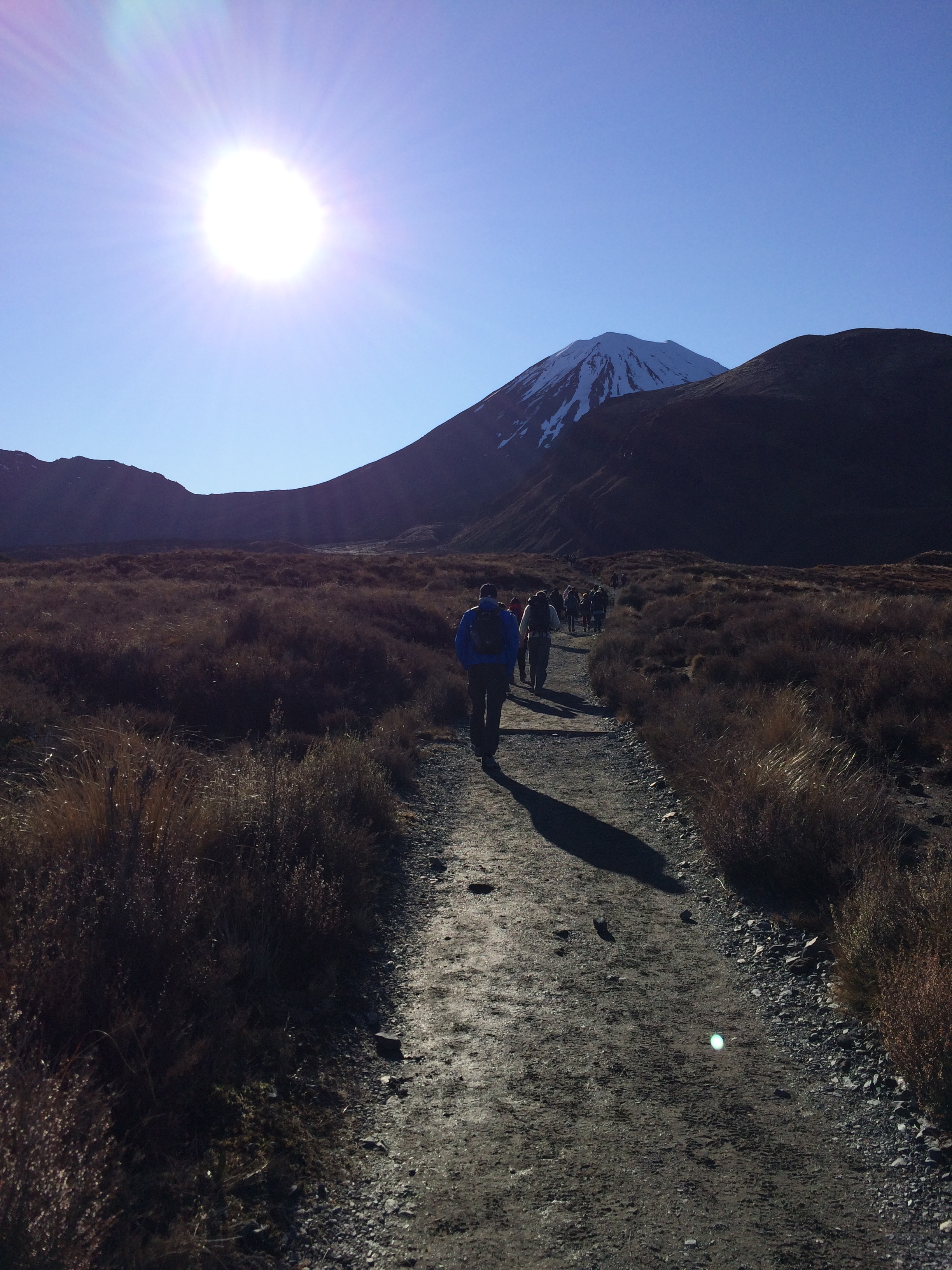
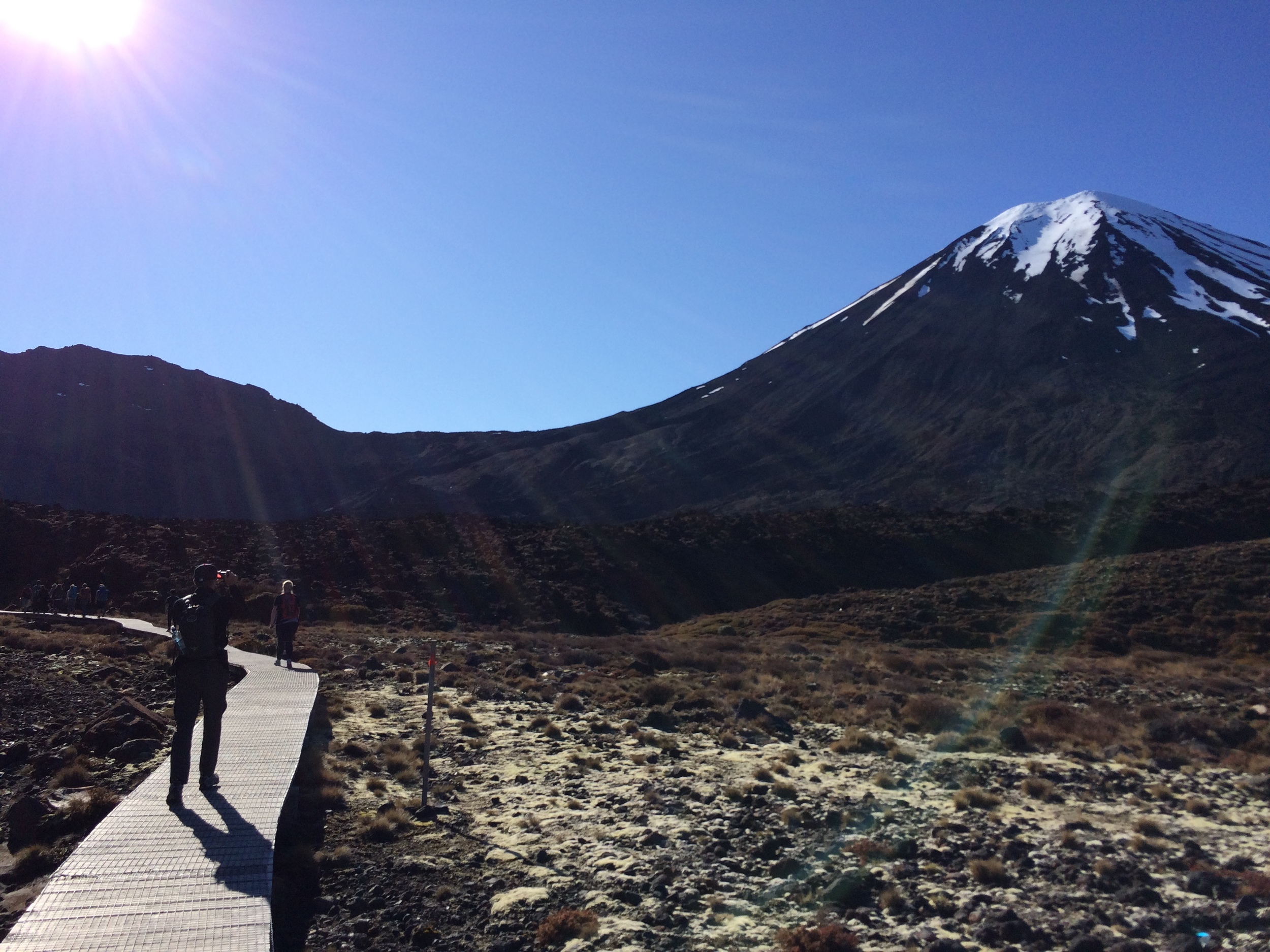
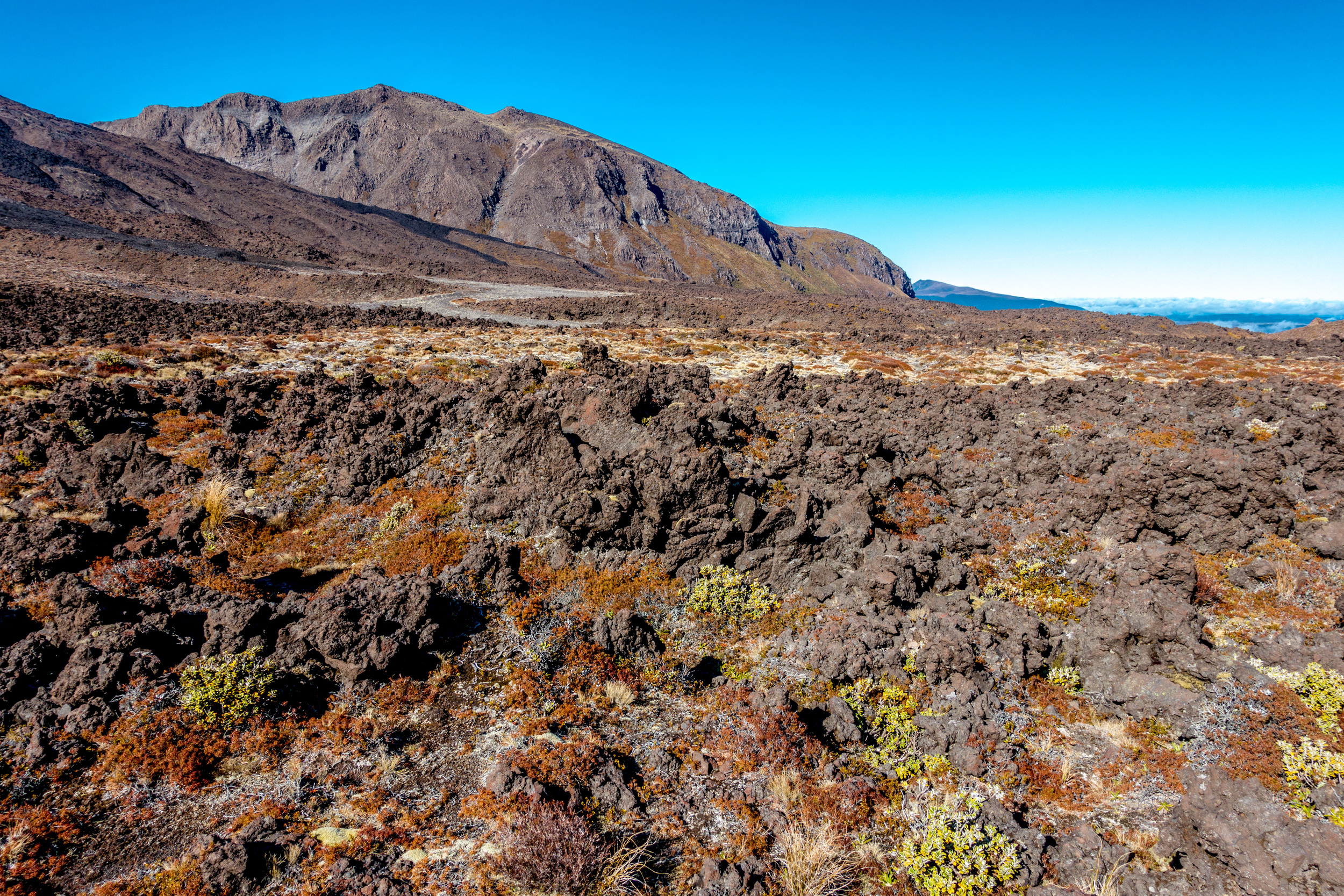
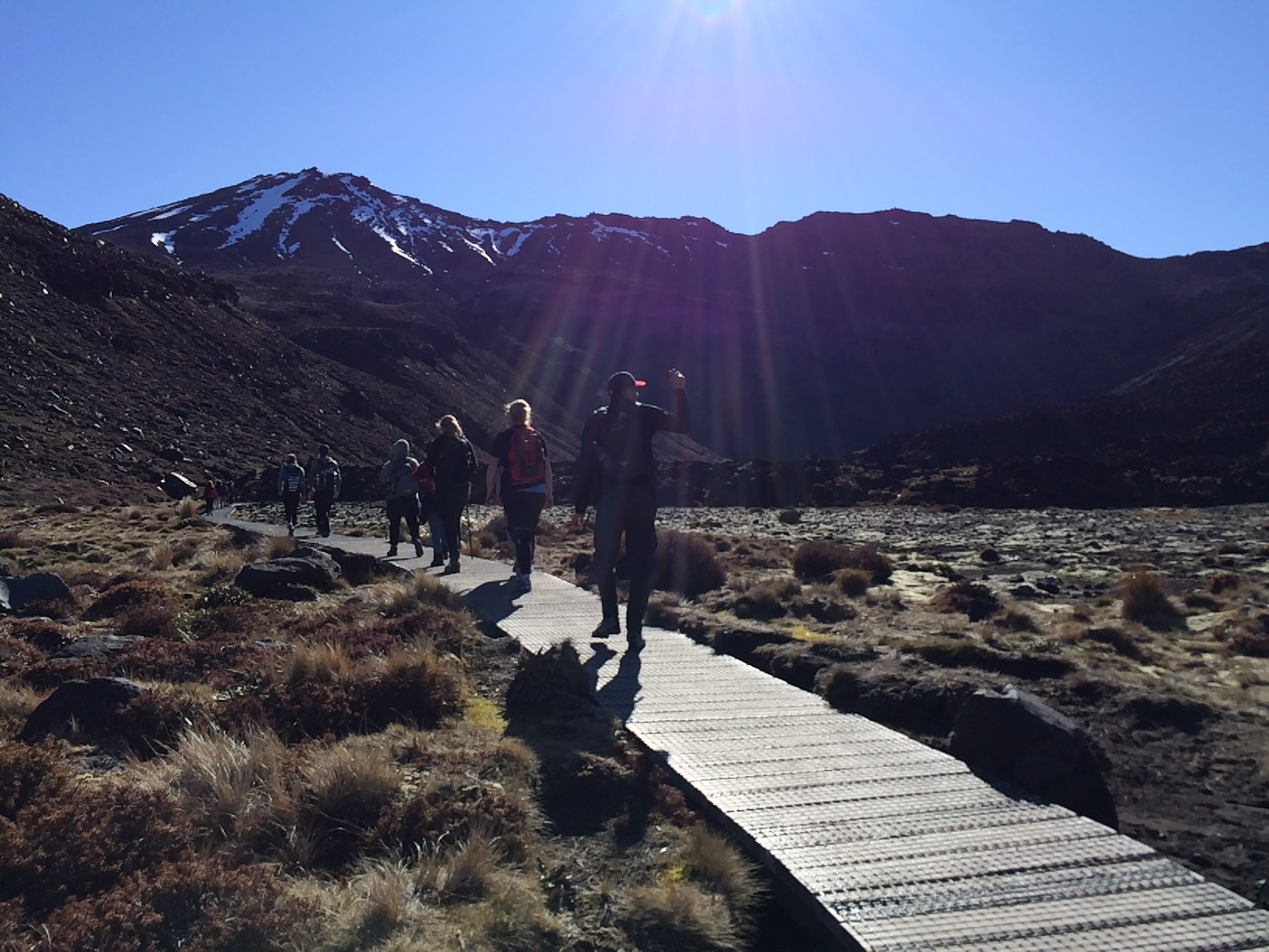
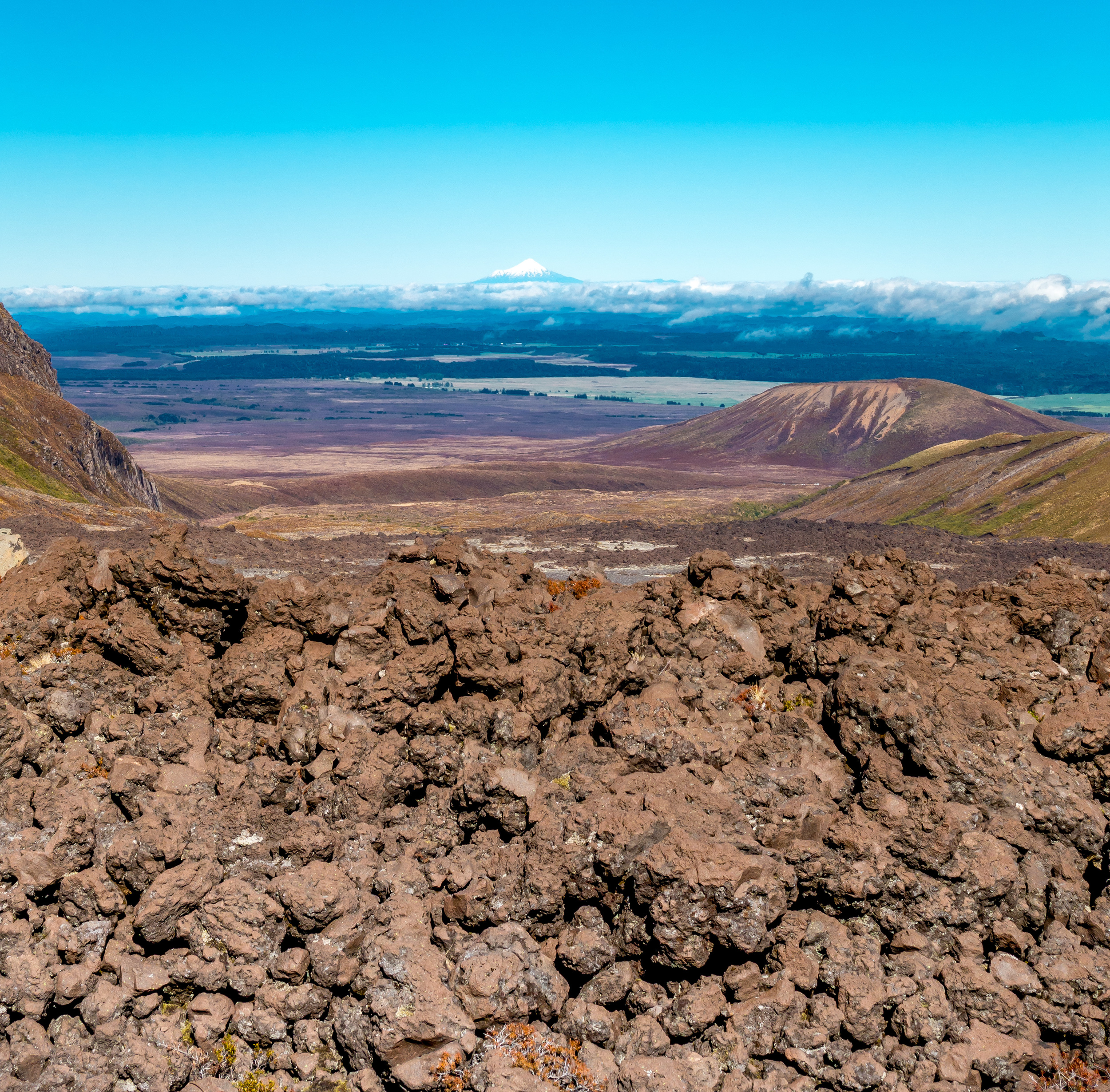
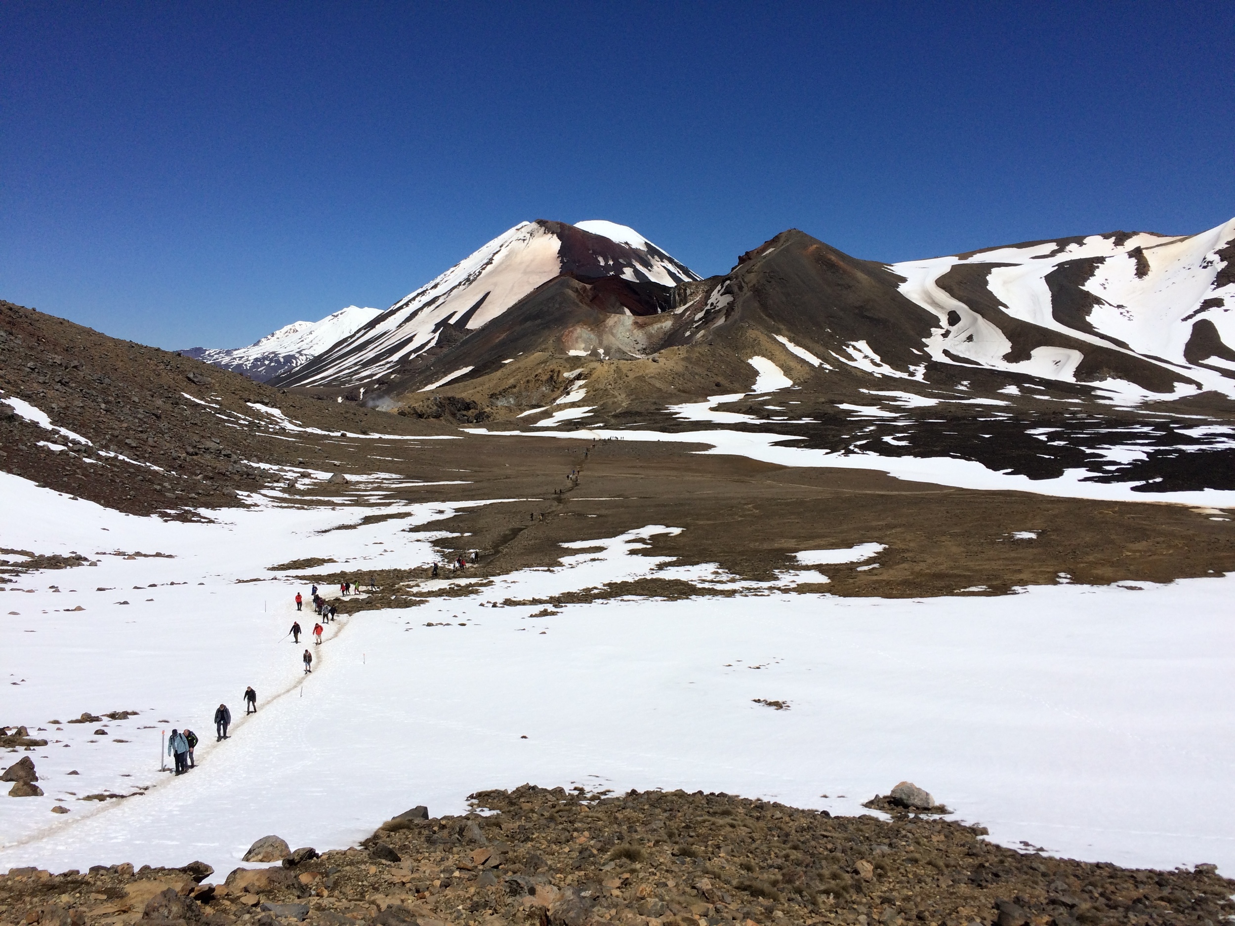
The first two hours of the walk are the easiest part. The mostly flat walk takes you through the valley and around Mt. Ngauruhoe (Mt. Doom). The paths are through grass, over volcanic rock and across boardwalks. Two of the three bathrooms are also in this first part. A very comfortable walk indeed!
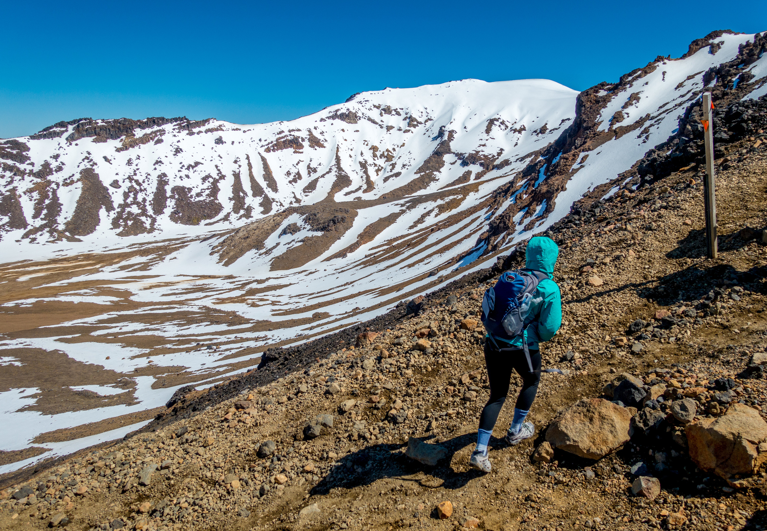
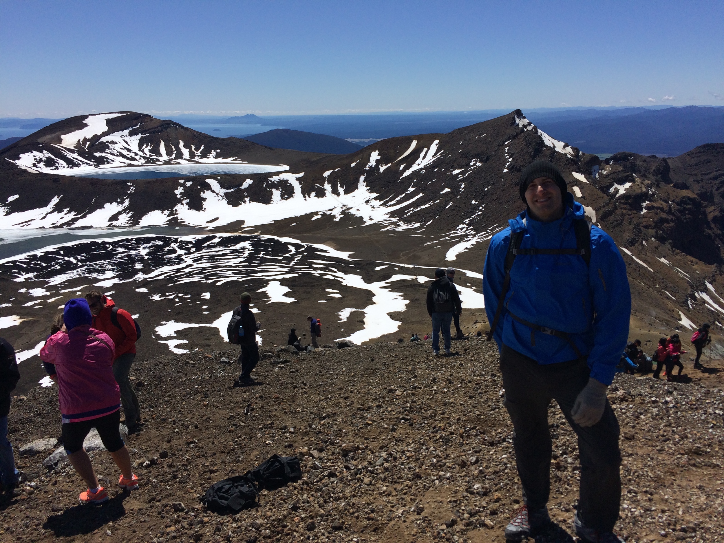
Part 2: Devils Staircase to just below Mt. Ngauruhoe (Mt. Doom)
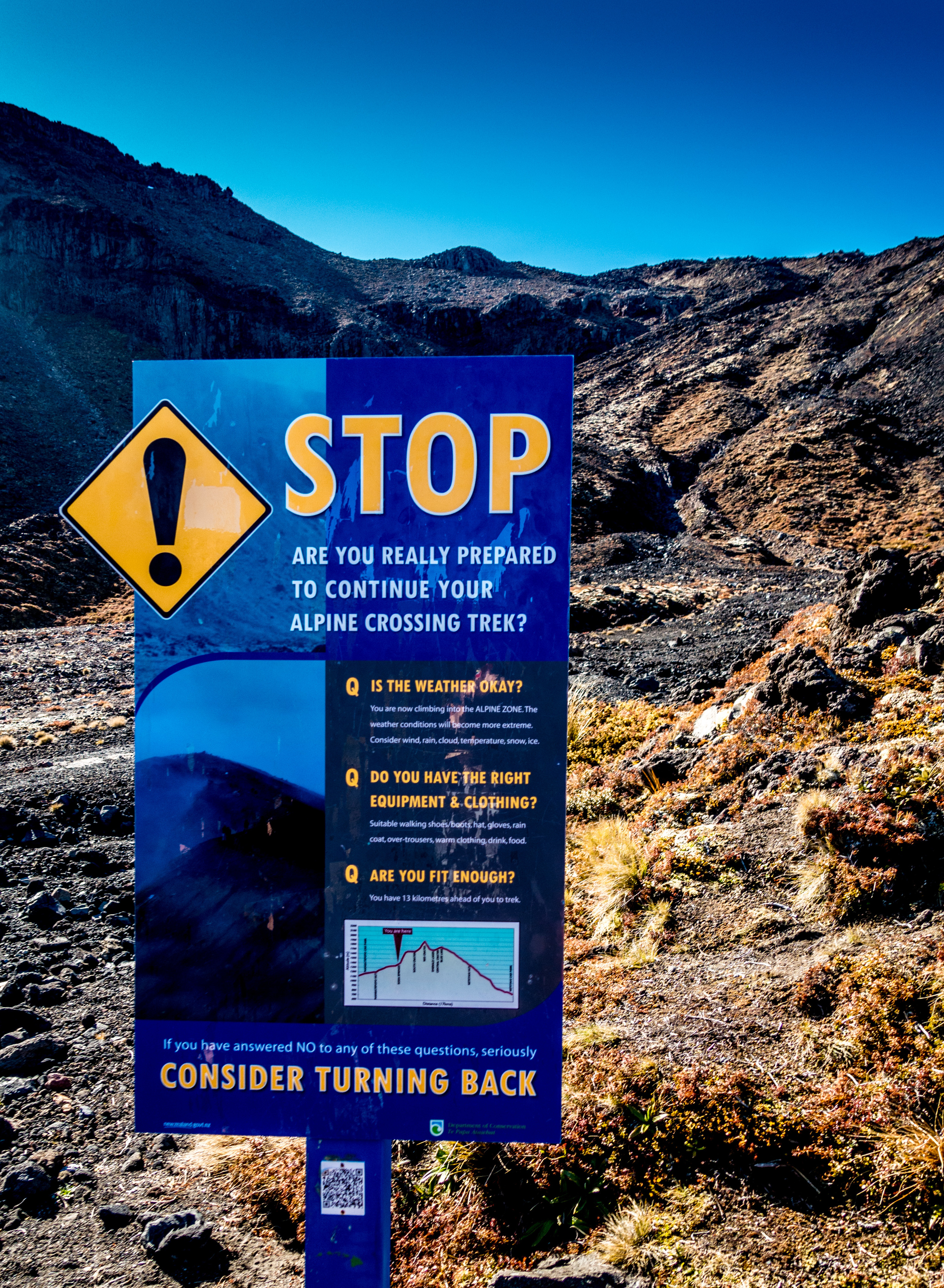
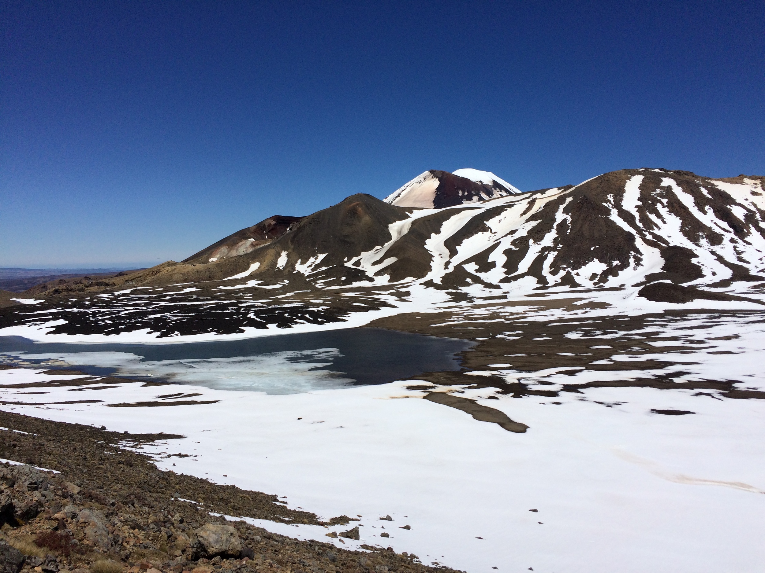
Before you start to climb "Devil's Staircase" there is a warning sign: STOP! ARE YOU SURE YOU'RE PREPARED...? There are no bathrooms for about the next 4 hours from here and you hike over 1000 vertical feet to the South Crater. At this point, it's hard to believe you aren't at the top yet. You have a great view of Mt. Taranaki, a picturesque coastal volcano, in the distance.
Some people will turn off the marked track here to actually go to the summit of Mt. Ngauruhoe. We heard it was quite dangerous for beginners as there are no maintained tracks and in Spring it is still very much covered in snow and ice. Still, we squinted and saw a large group make the ascent to the top.
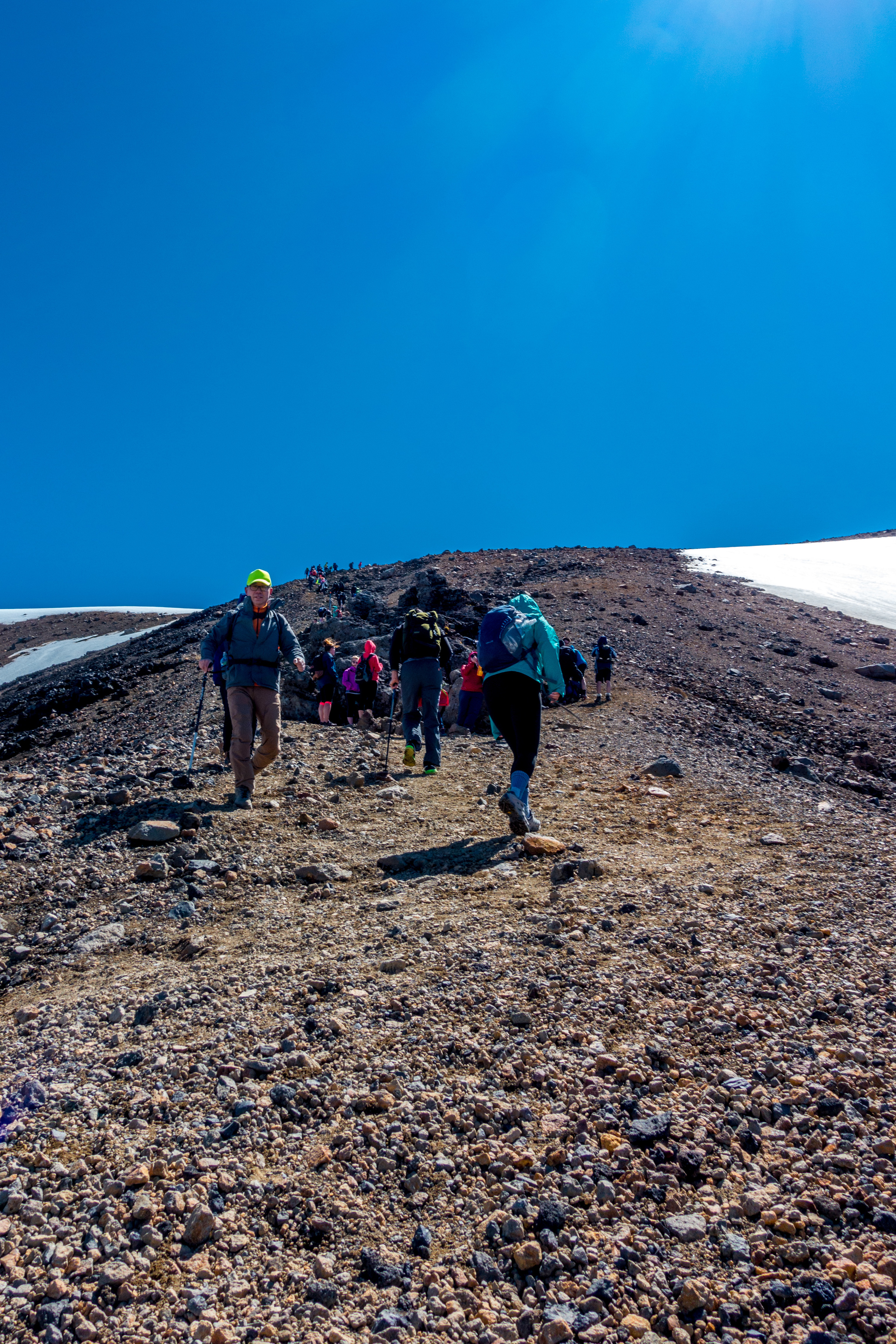
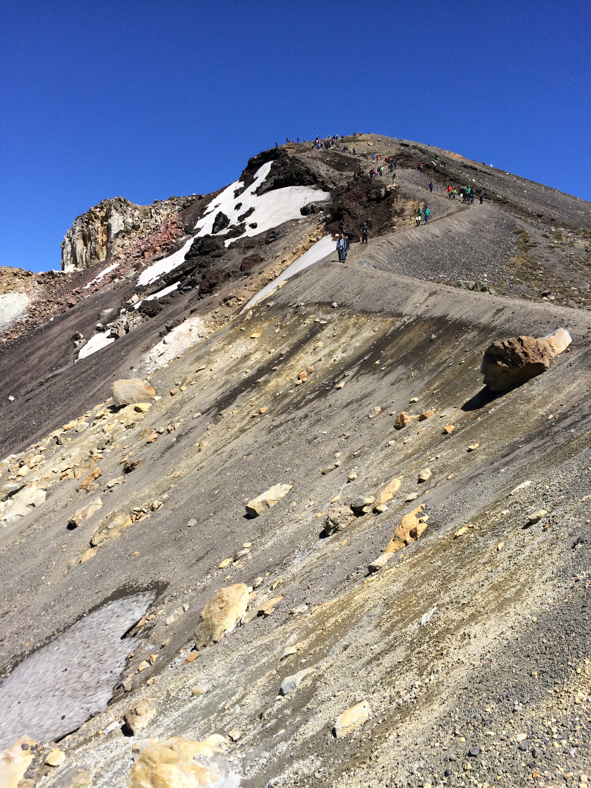
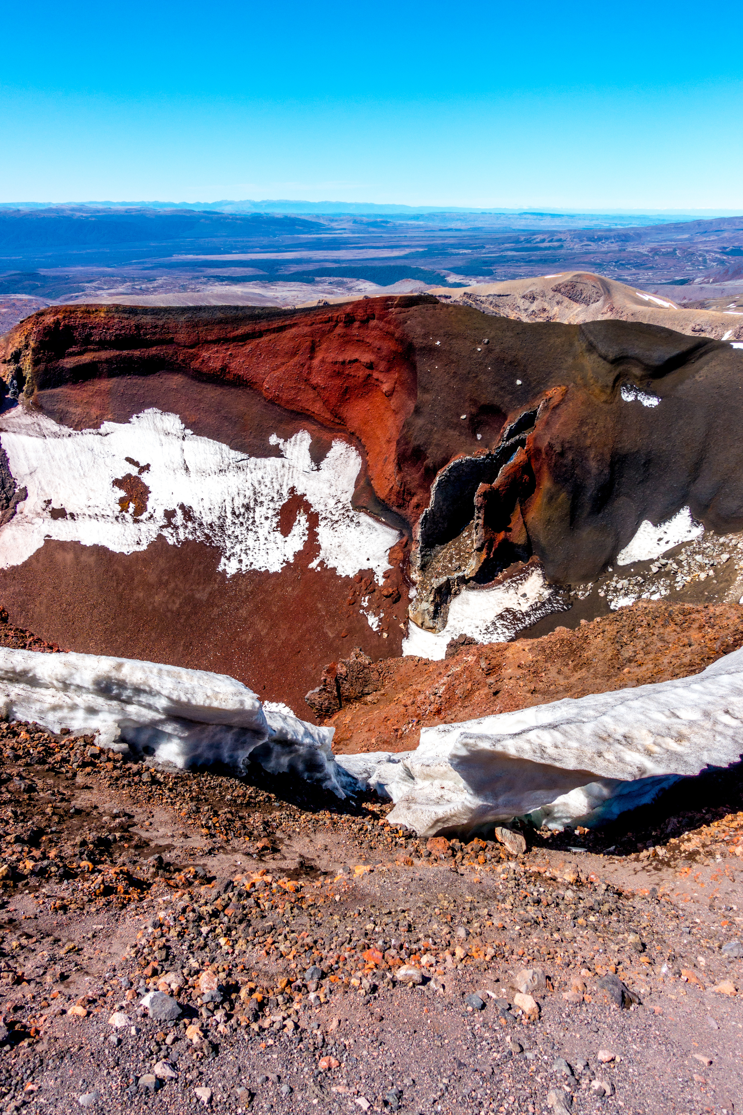
Part 3: Mt. Doom Turnoff to Summit
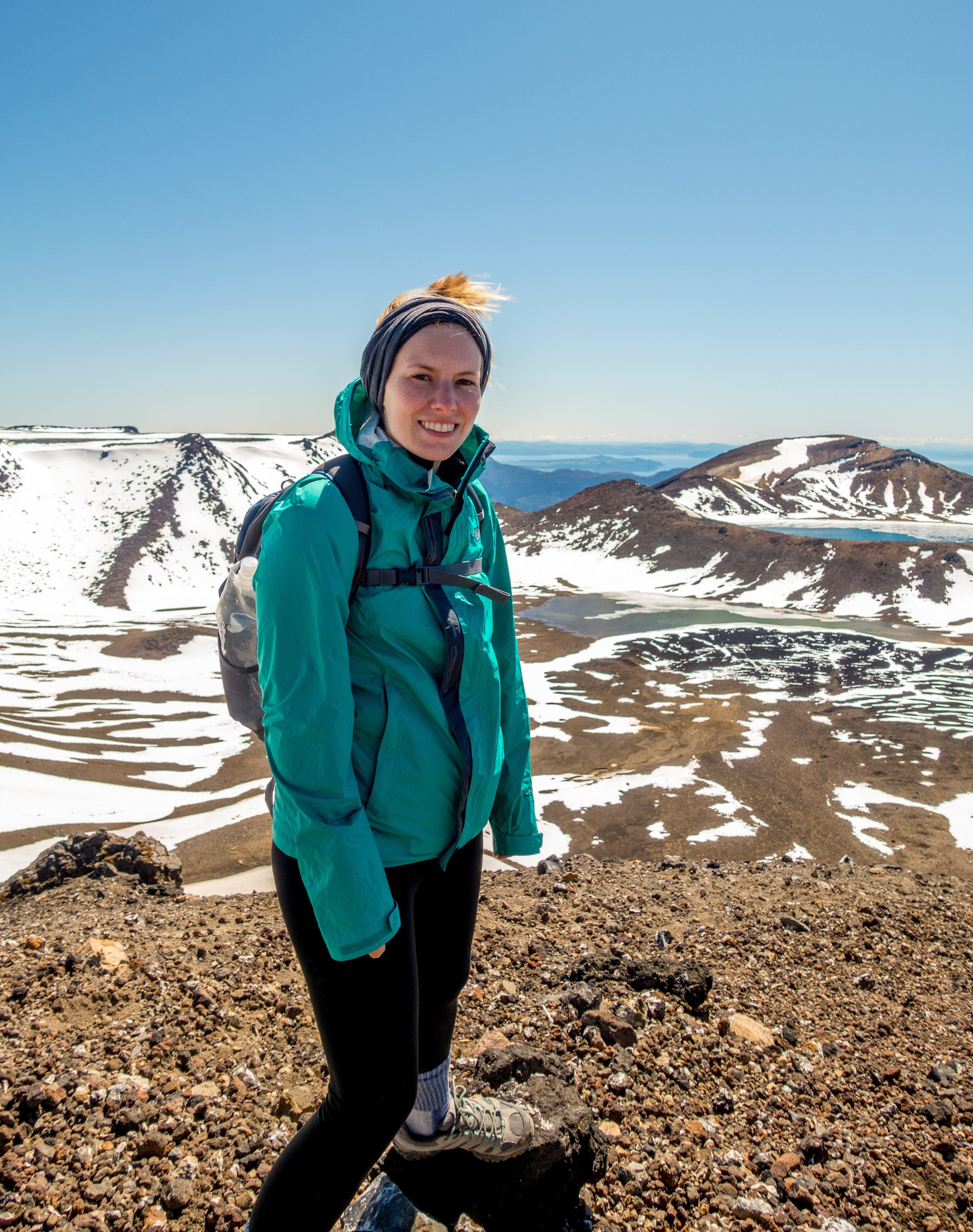
This is the most challenging part: you've already hiked for at least 3 hours in the bright sunlight, the higher you get the colder and windier it is, and now the incline gets steep enough that you are grabbing onto rocks to move forward. Smaller rocks slip beneath your feet. At one point, there are several feet of chain-rope to grab onto as you navigate around boulders, a cliff just a few inches from the back of your shoes. The views of the craters, of Mt. Doom and the line of people are a lot to take in while also trying to keep your footing and push onward.
The cold air really pierced my lungs - luckily the Buff I brought along can cover my ears, nose, mouth and neck if necessary. What was an impulse buy at REI has saved my ears on numerous hikes so far this trip!
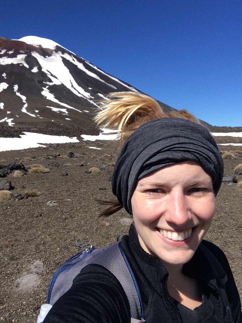
After hiking almost another 1000 vertical feet, you reach the summit of The Crossing at 6,187ft. Success! And time for a snack. You still have about 3 hours of (mostly downhill) hiking left.

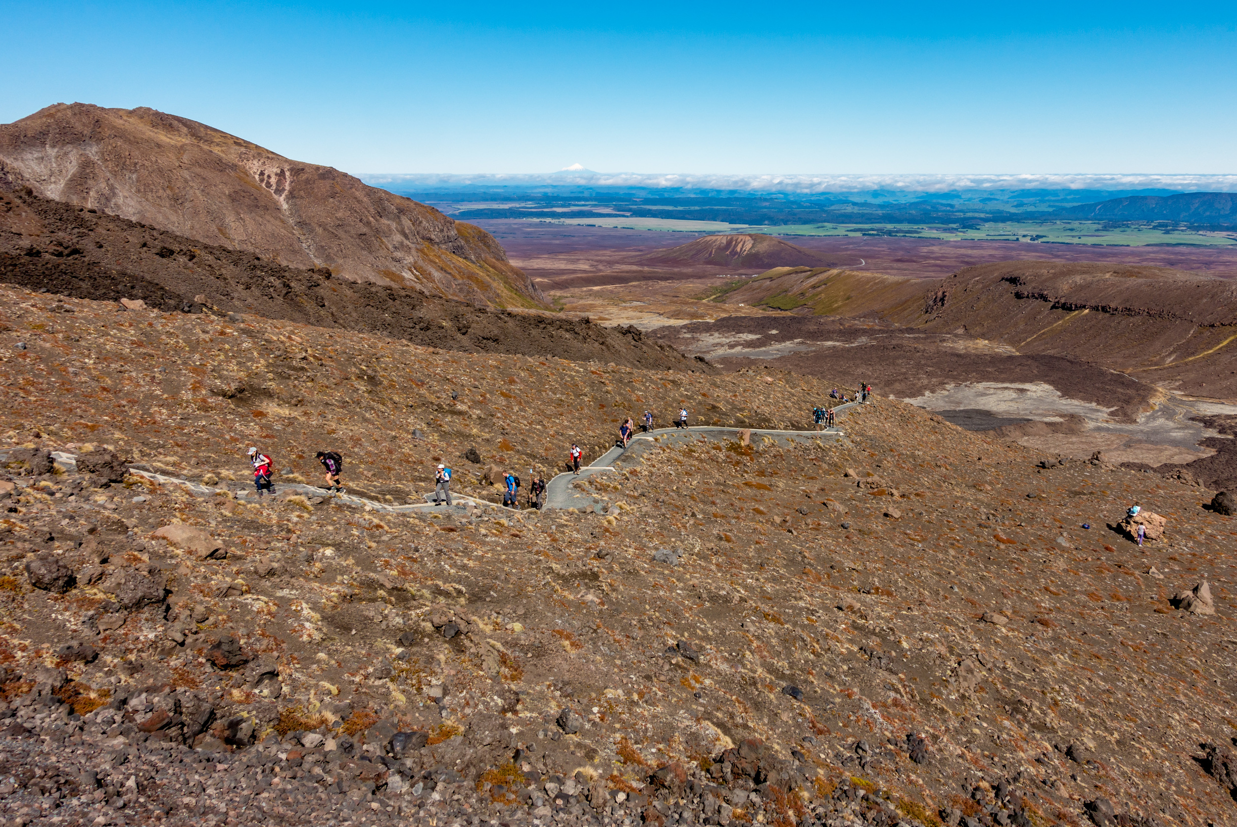
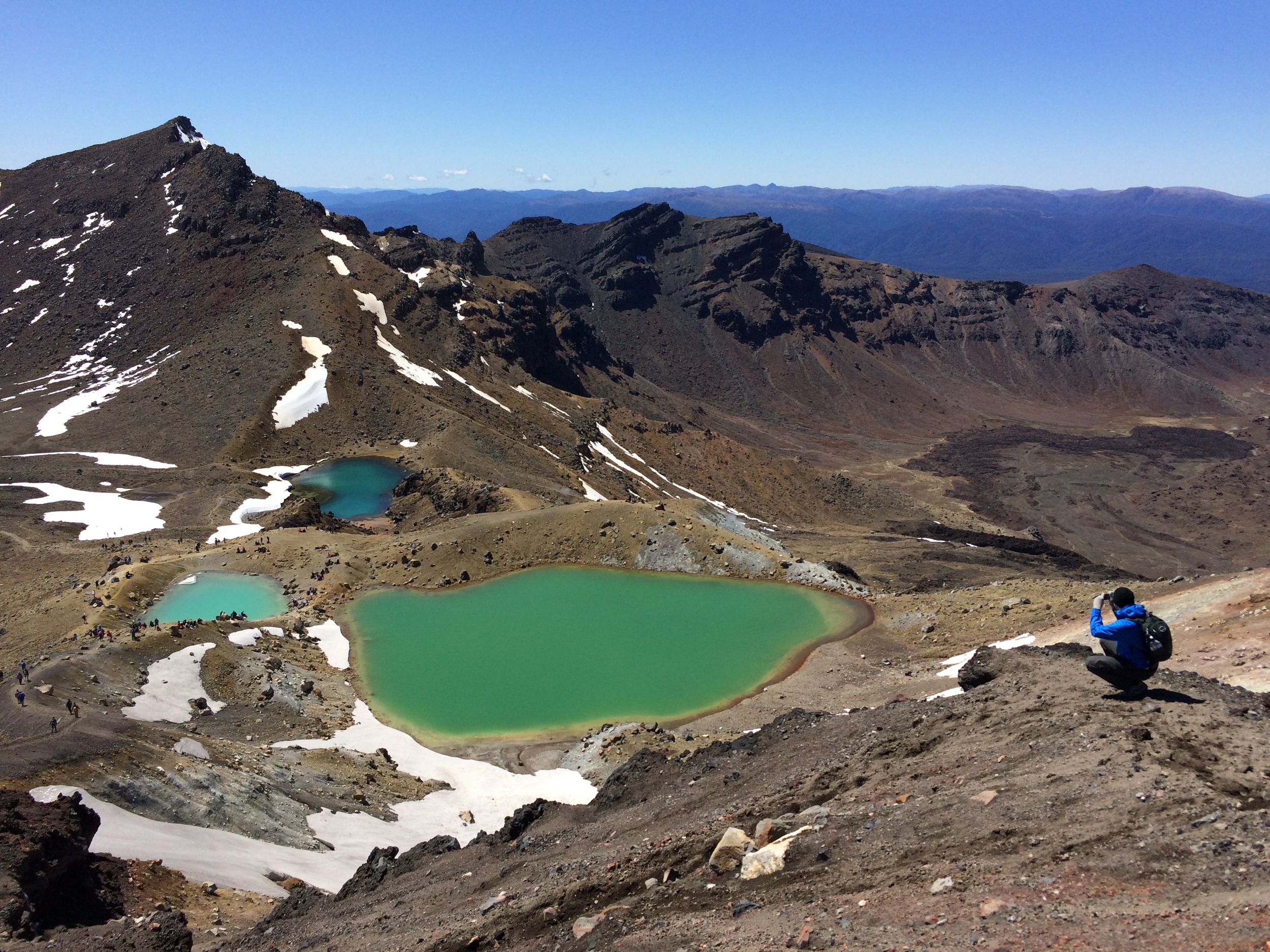
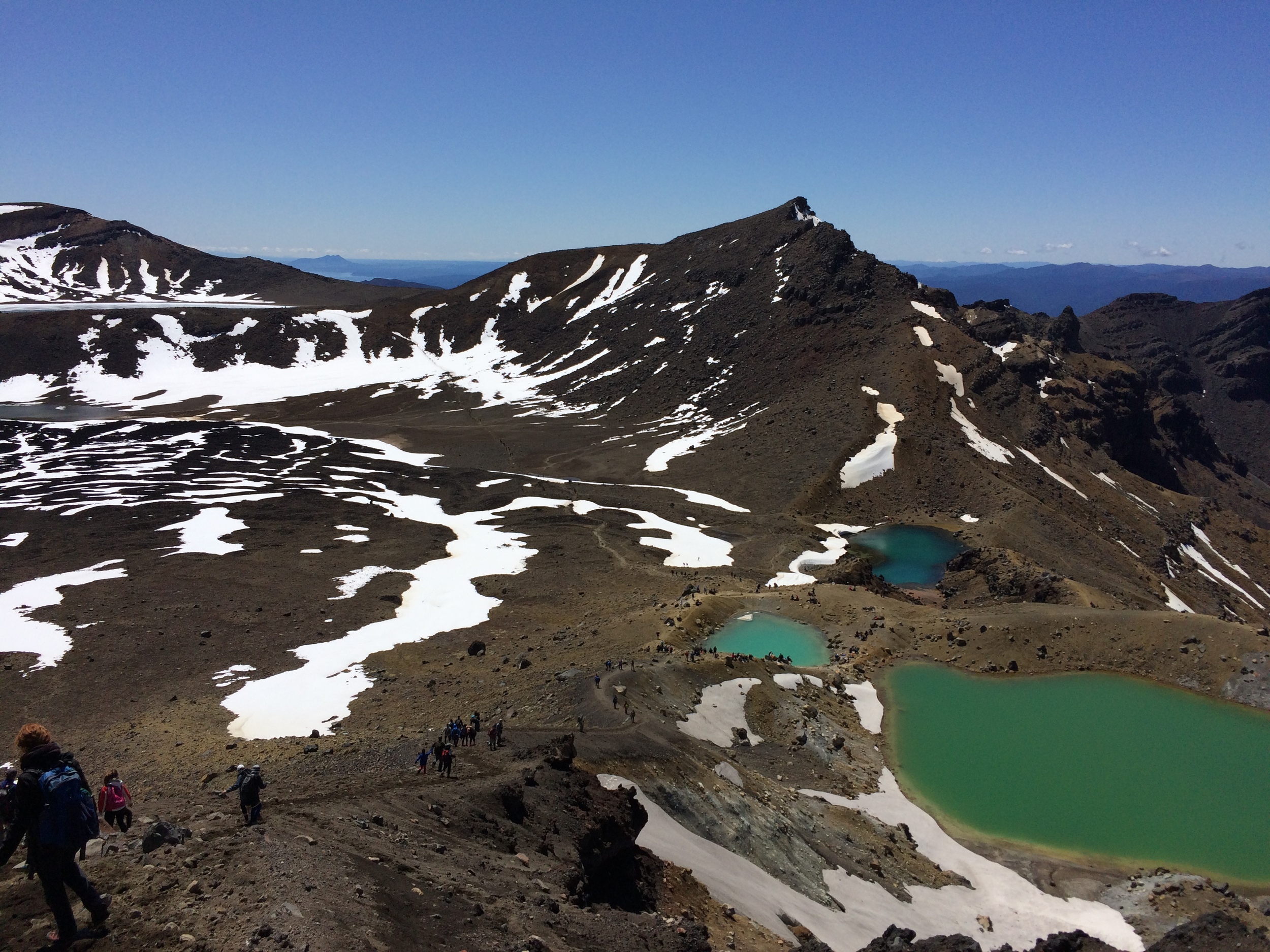
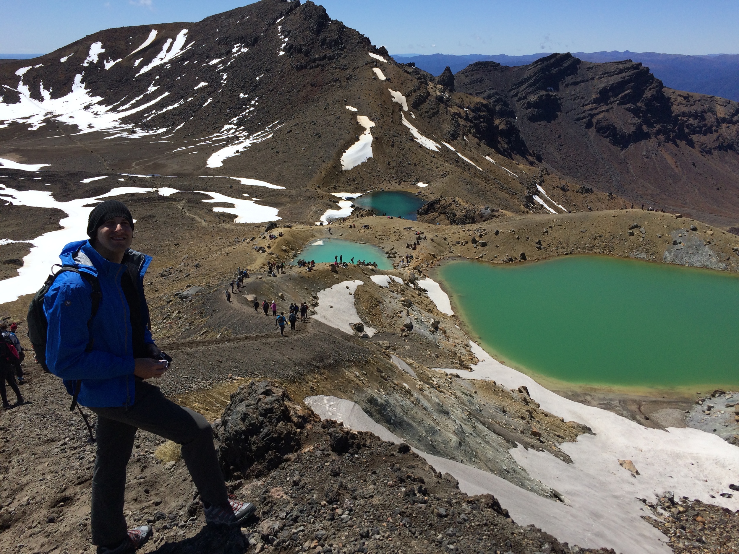
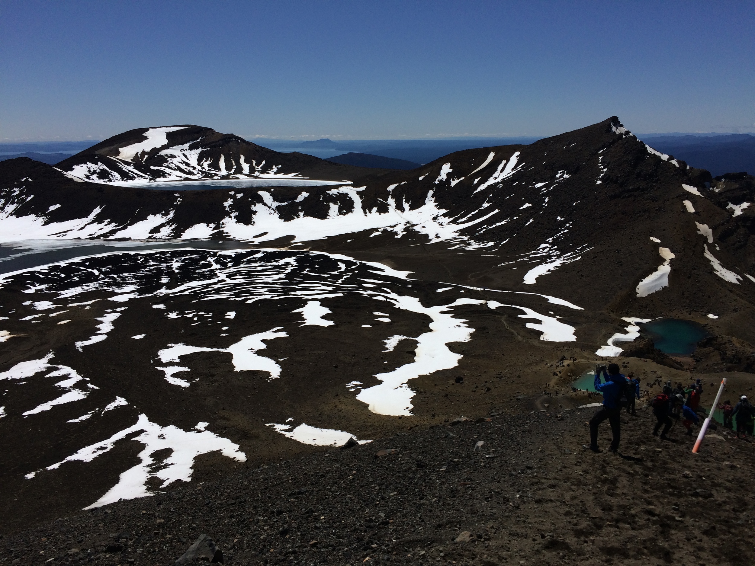
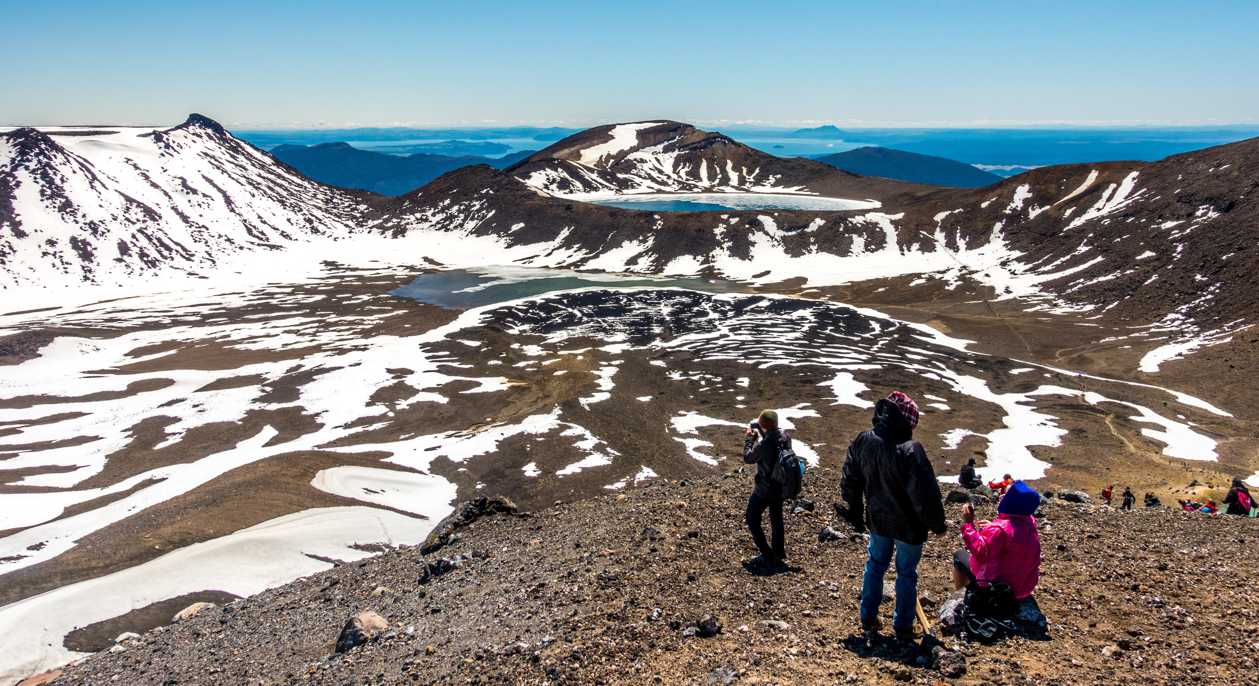
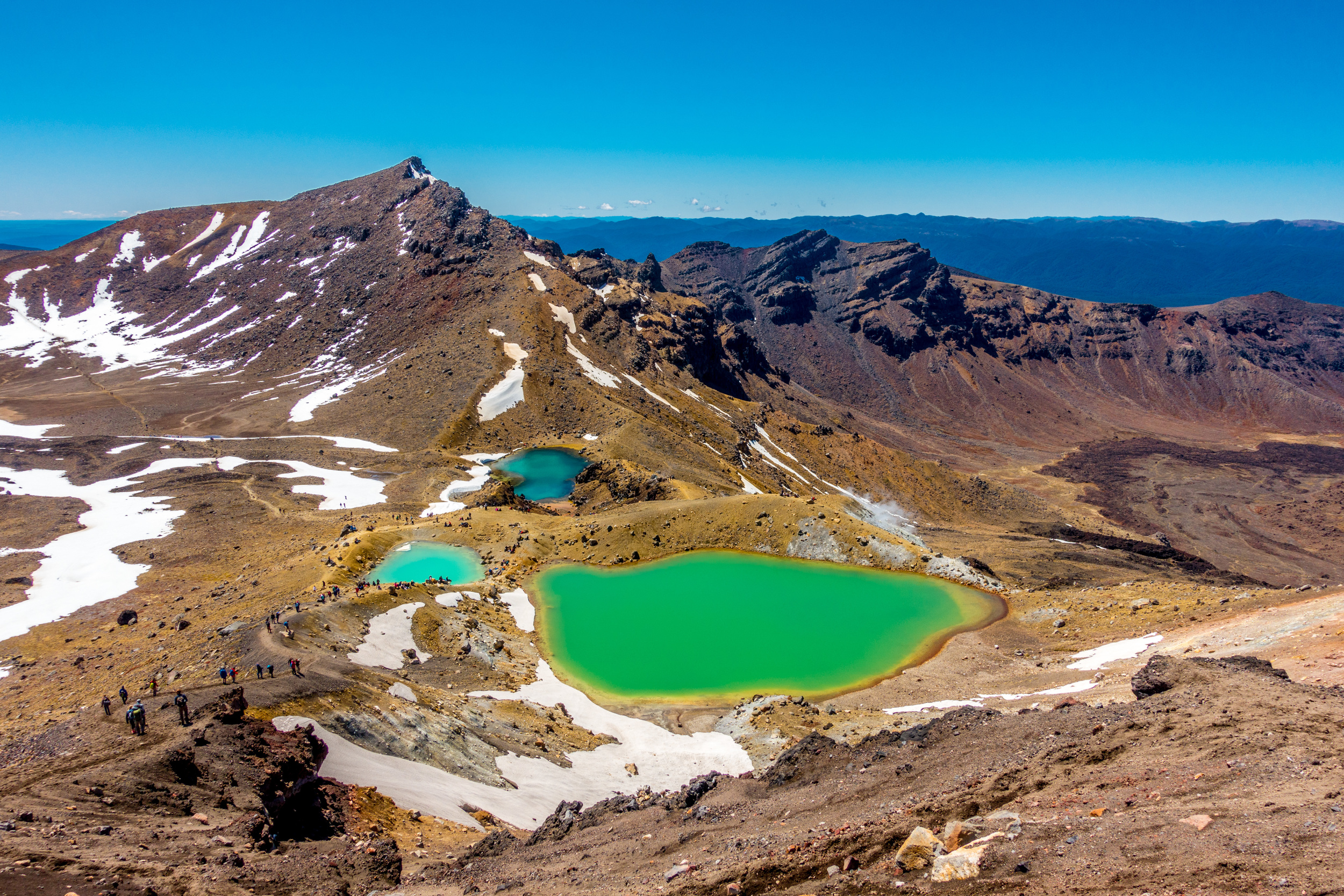
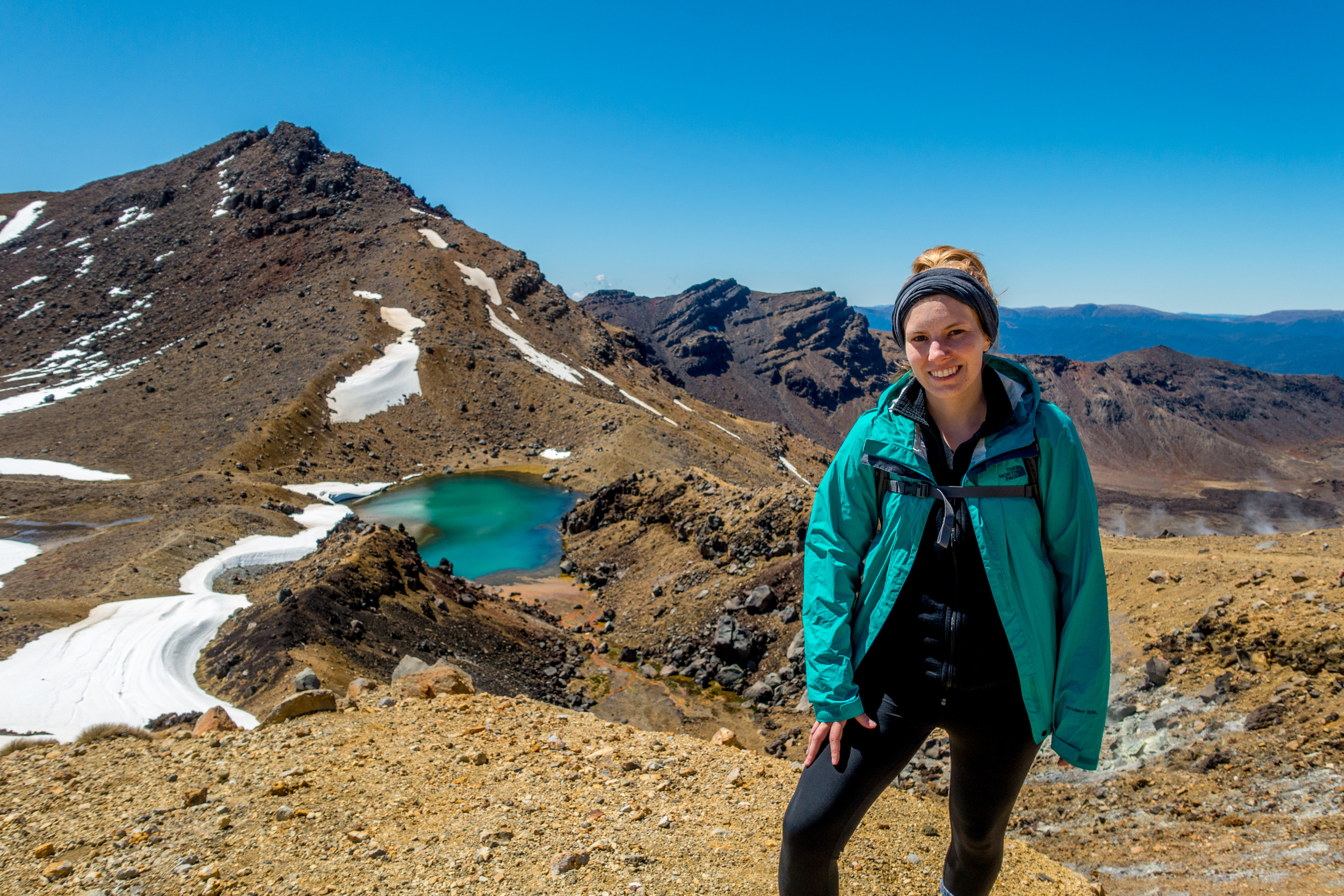
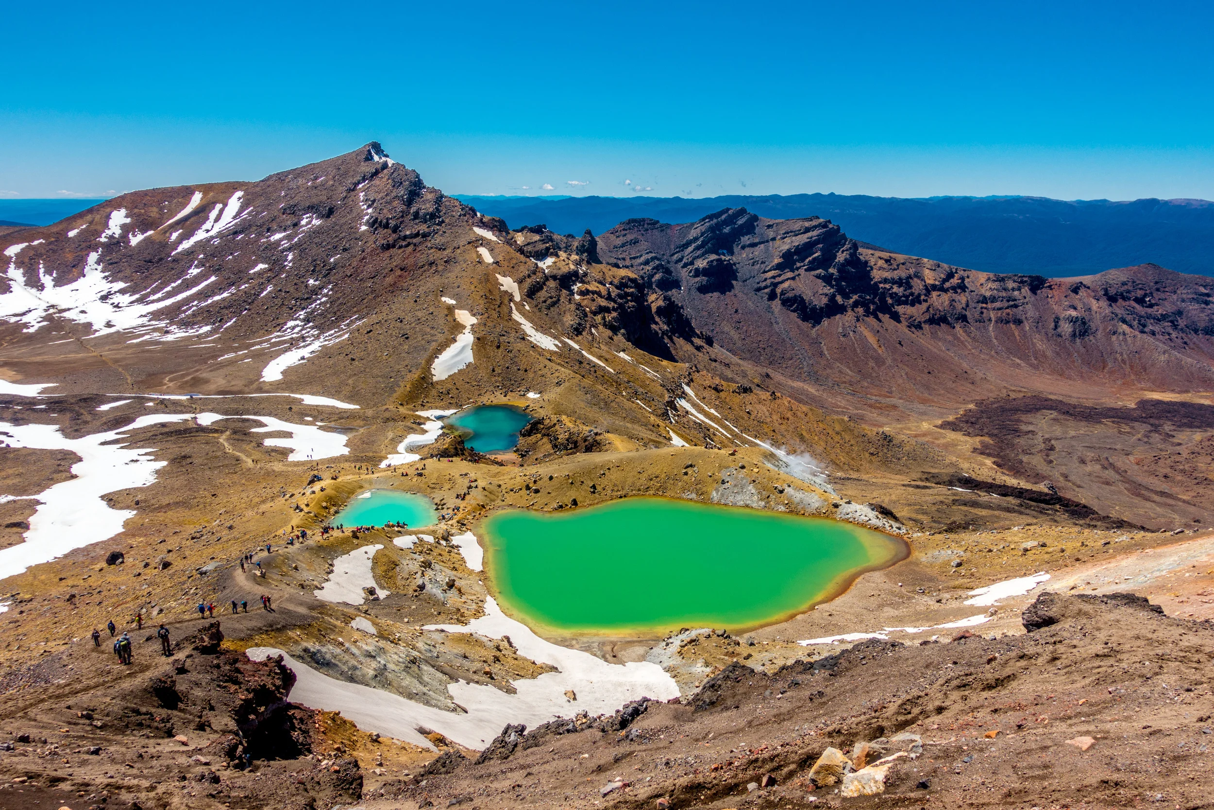
Part 4: Summit to Red Crater and Emerald Lakes
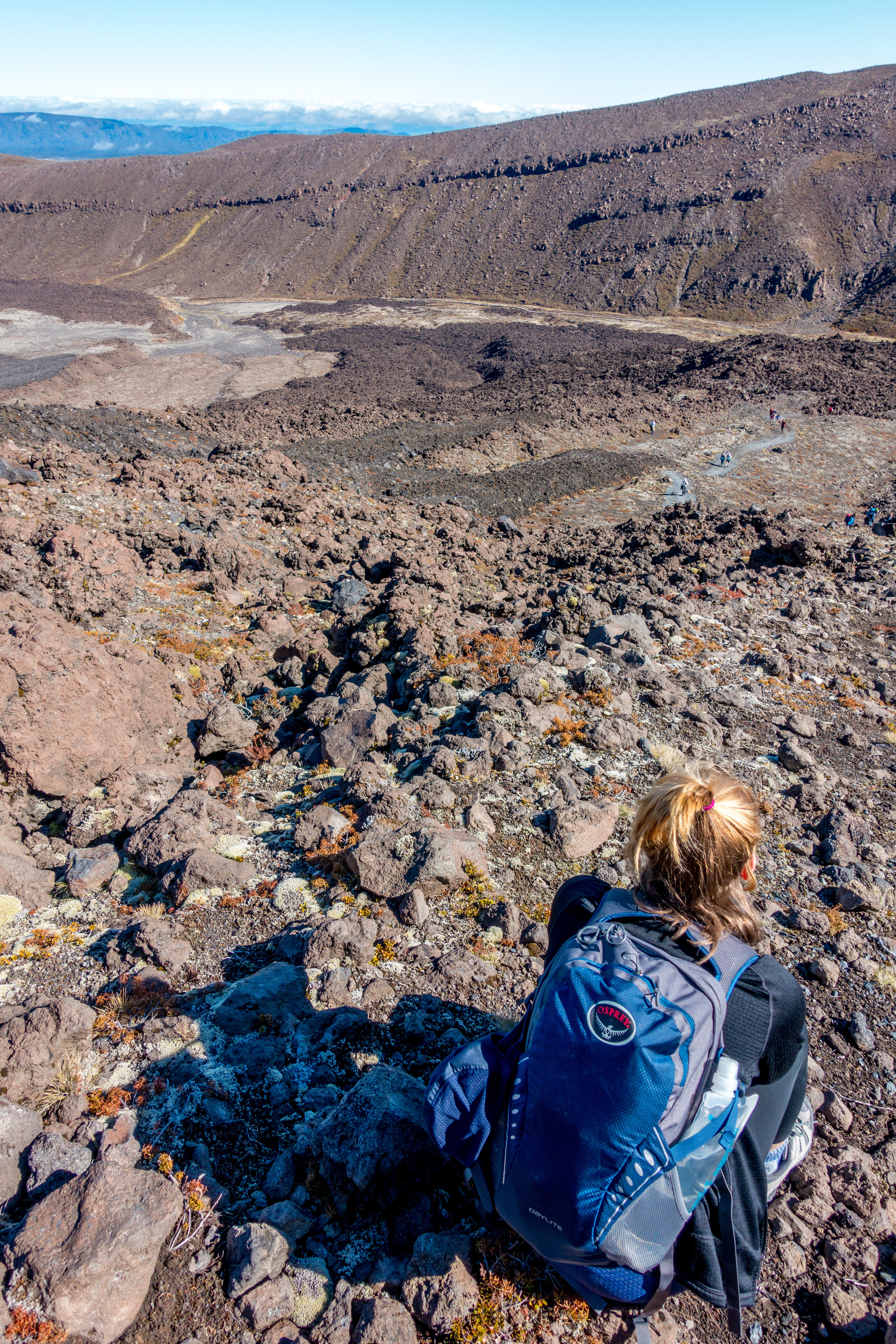
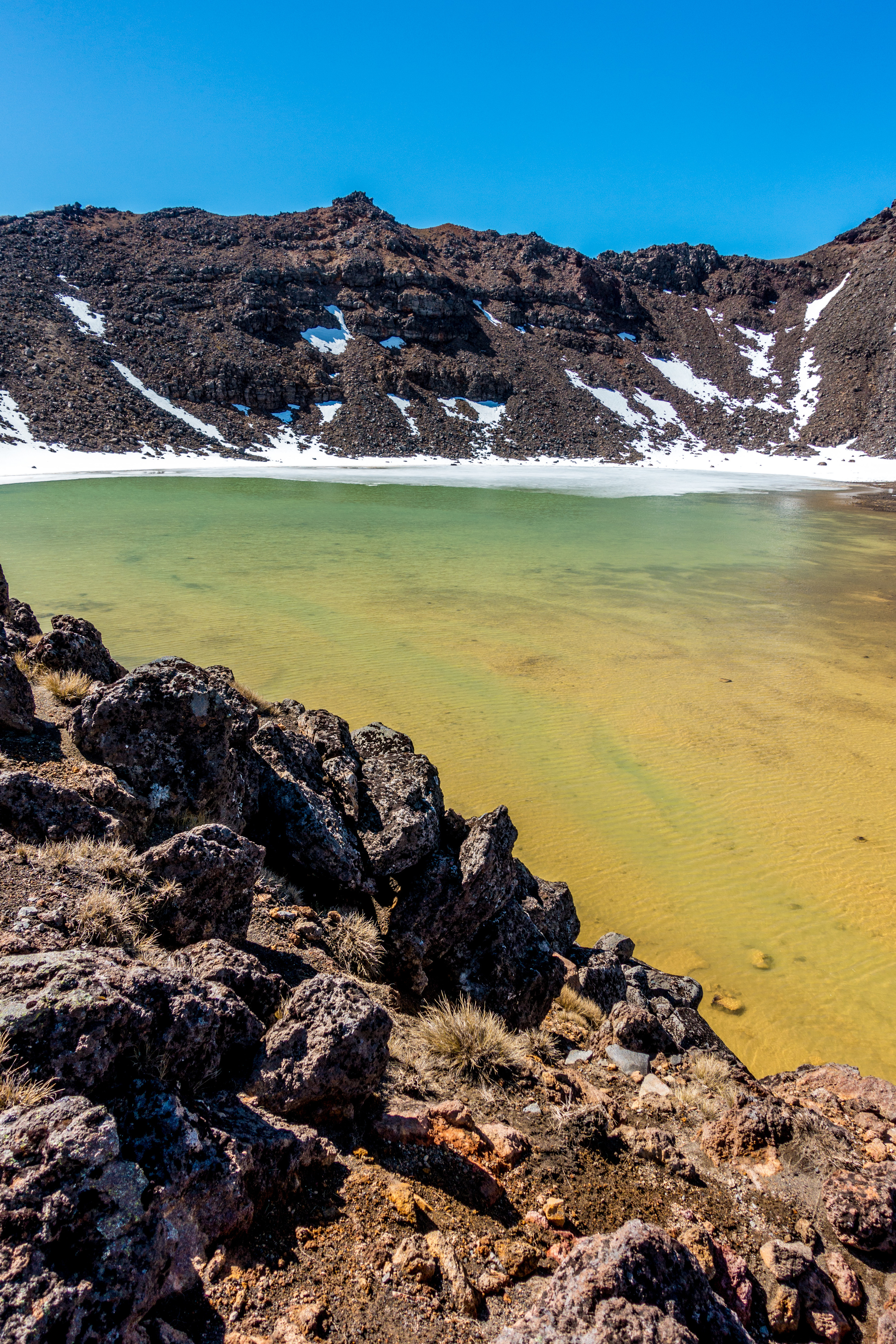
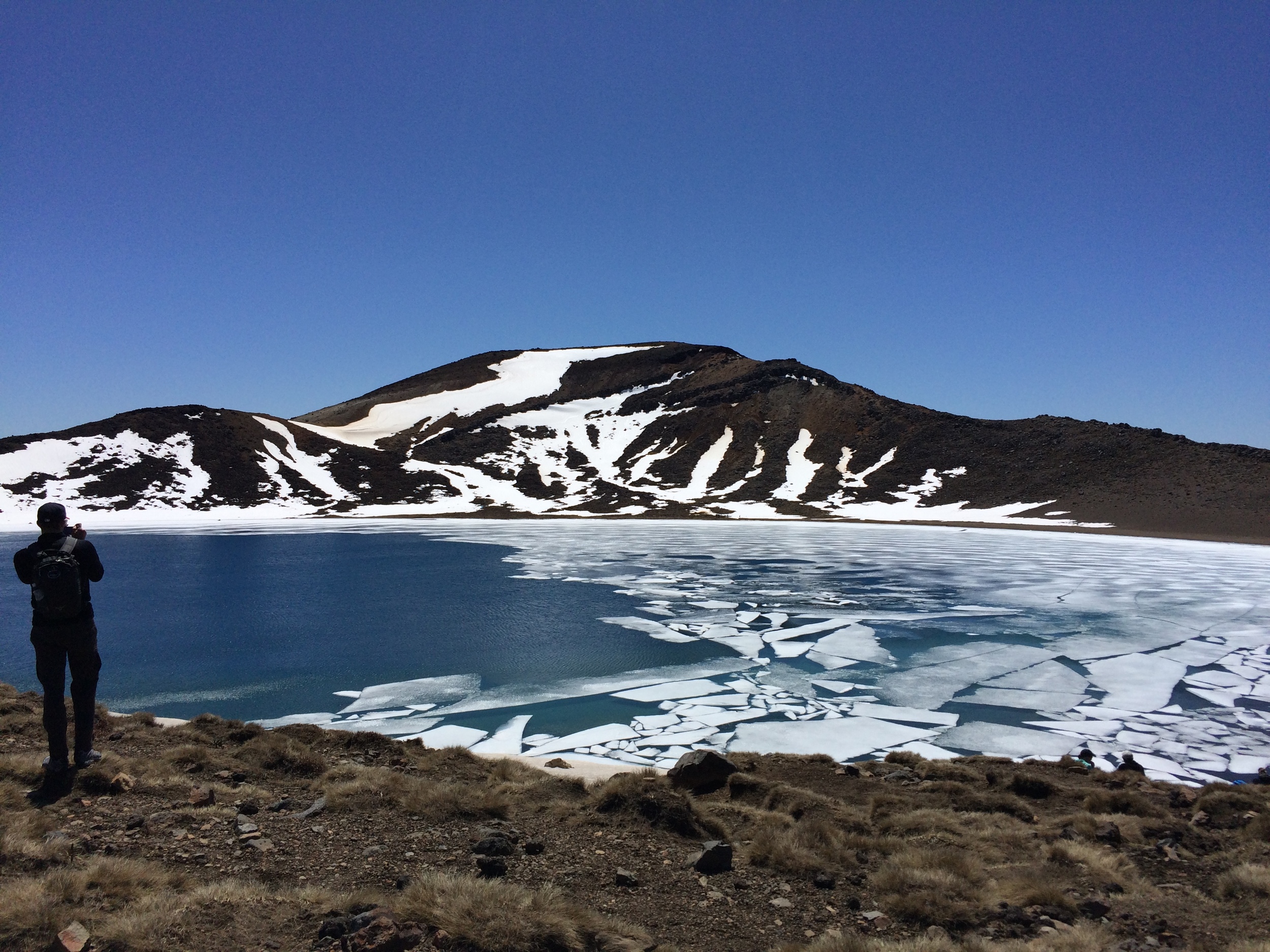
Another group of people split off at this point, presumably to continue the full Circuit. Those walking The Crossing are quickly rewarded again with views of the Red Crater. You are literally walking along the edge of a crater until the next great views - the large ice covered lake in the distance, and the Emerald Lakes down below you. Getting down to them is the tricky part.
The step incline down is covered in what felt like fine sand. Hikers were basically sitting and sliding down. Once you accept that you probably will slip and fill your shoes with this dirt or ash or sand - whatever it is - it's not too bad. Just stay as far from other people and the edge as you can!
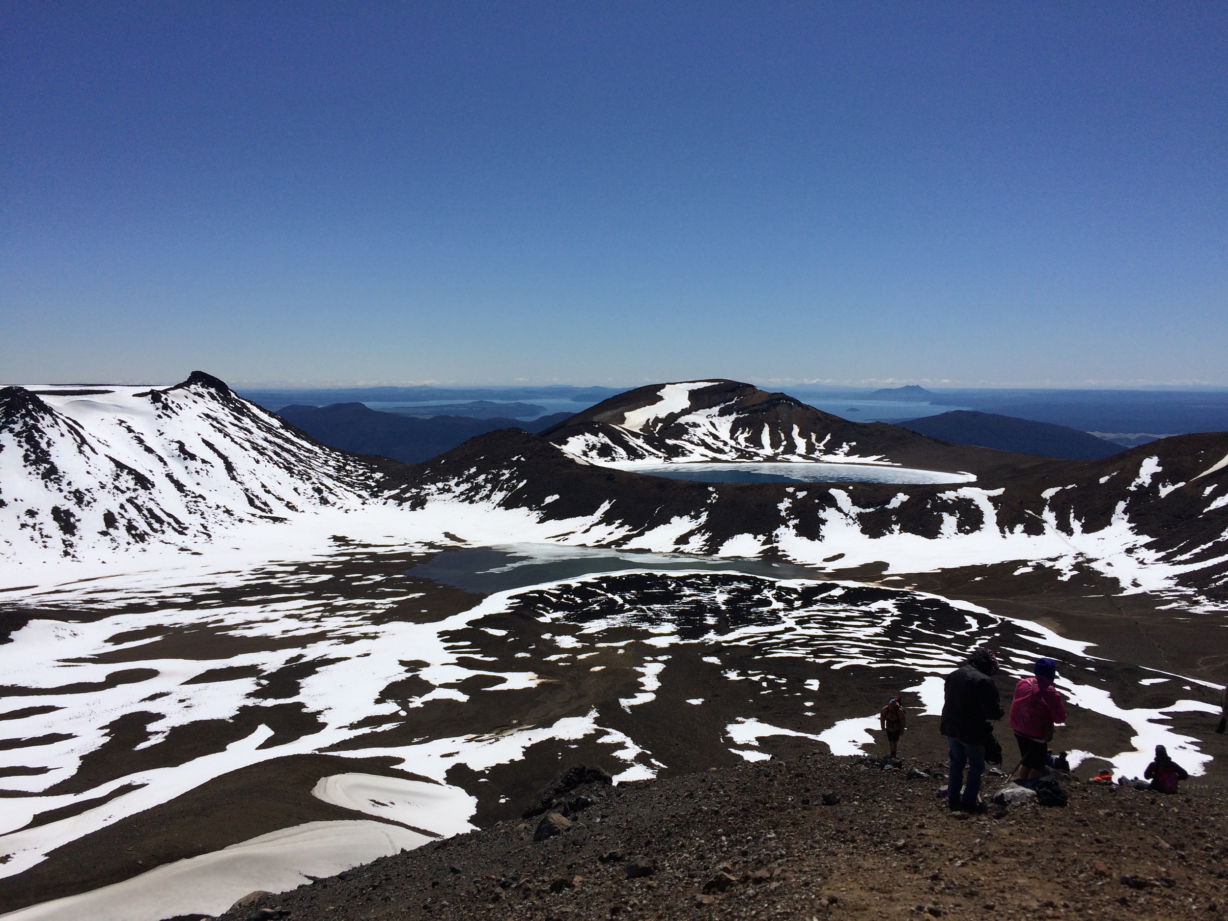
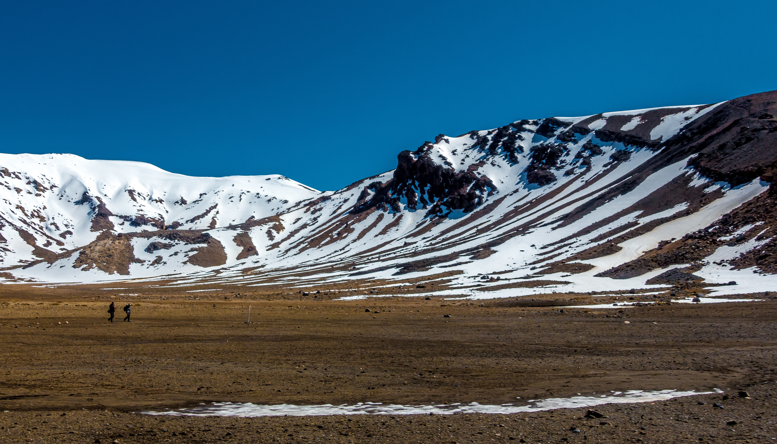
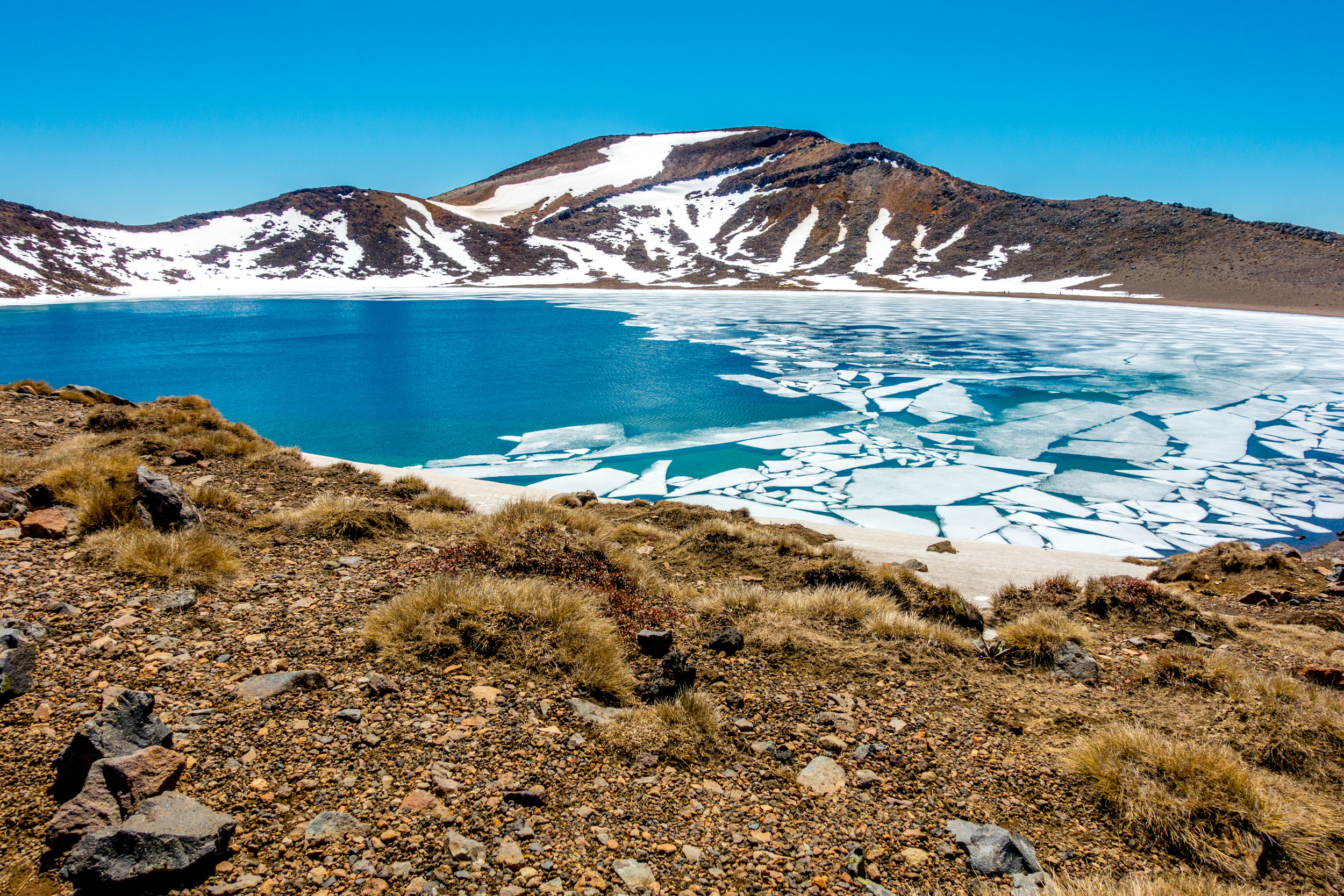
Part 5: Past Blue Lake and around Te Maari
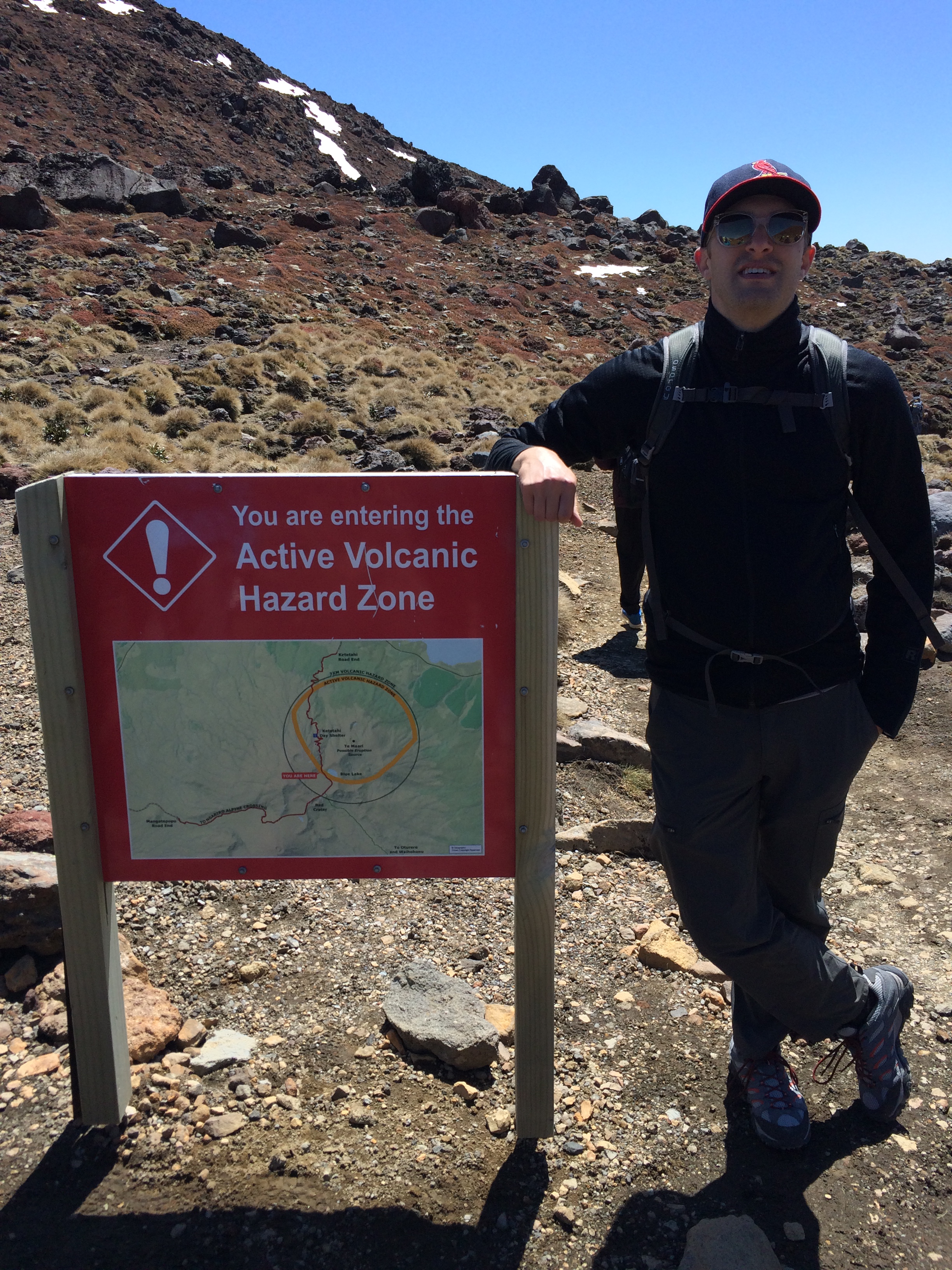
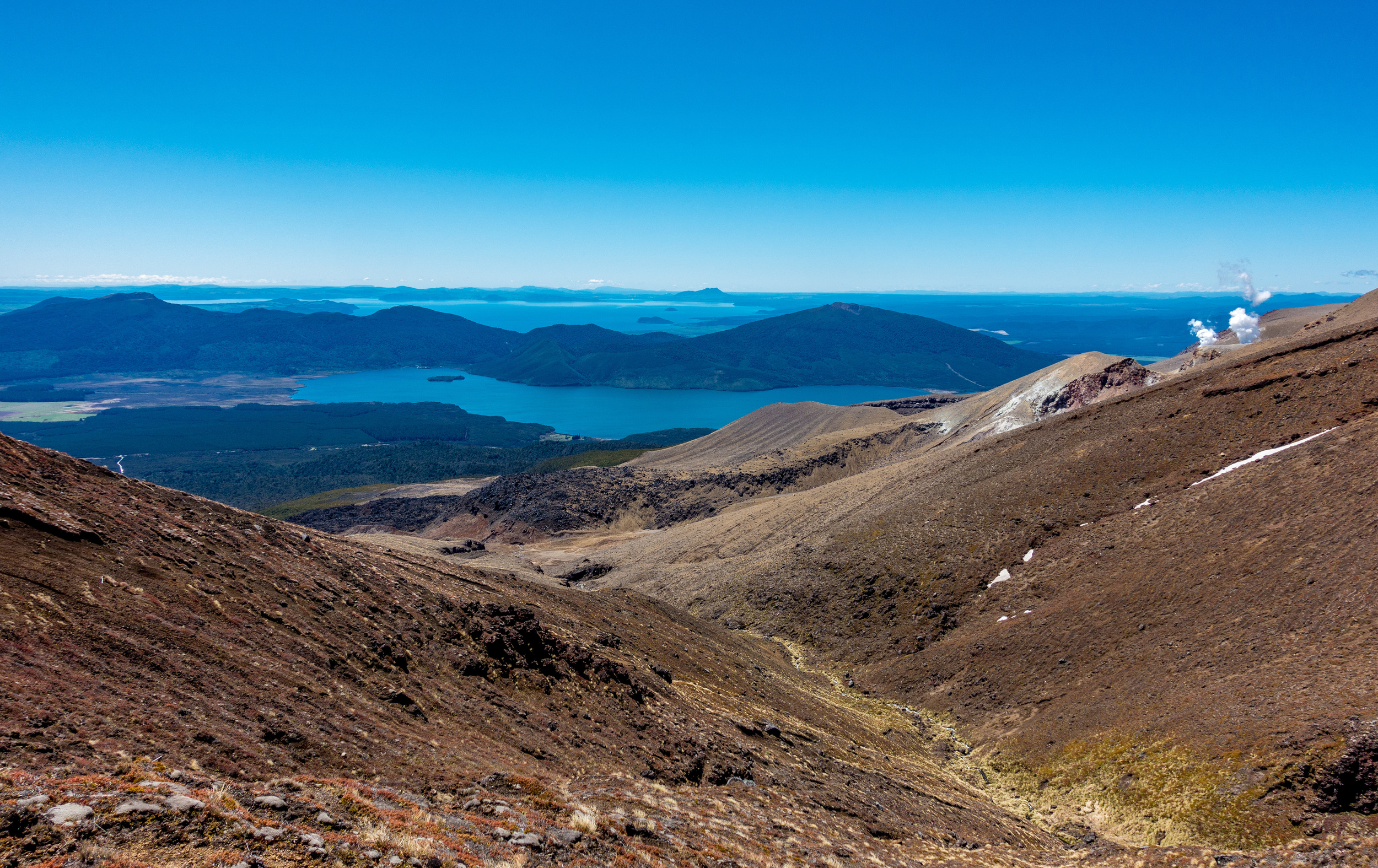
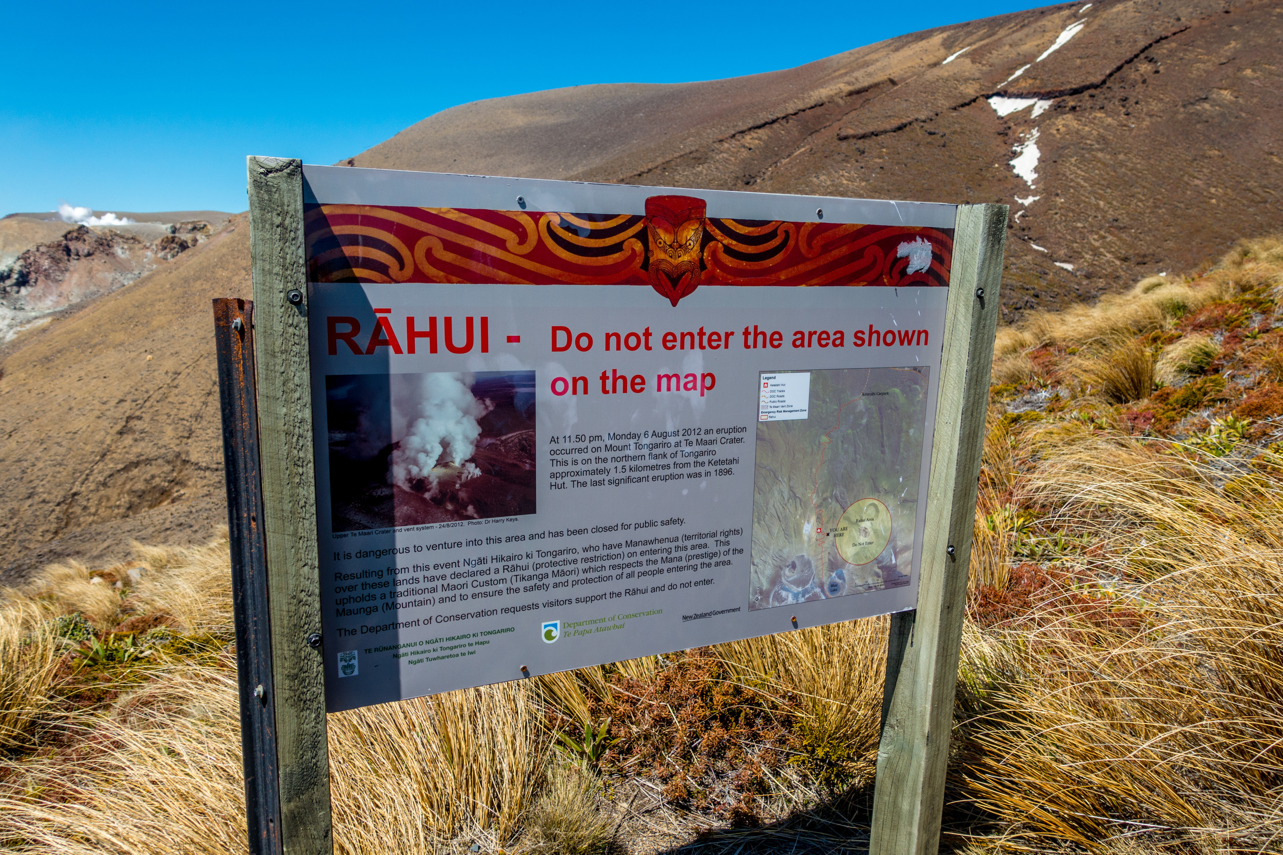
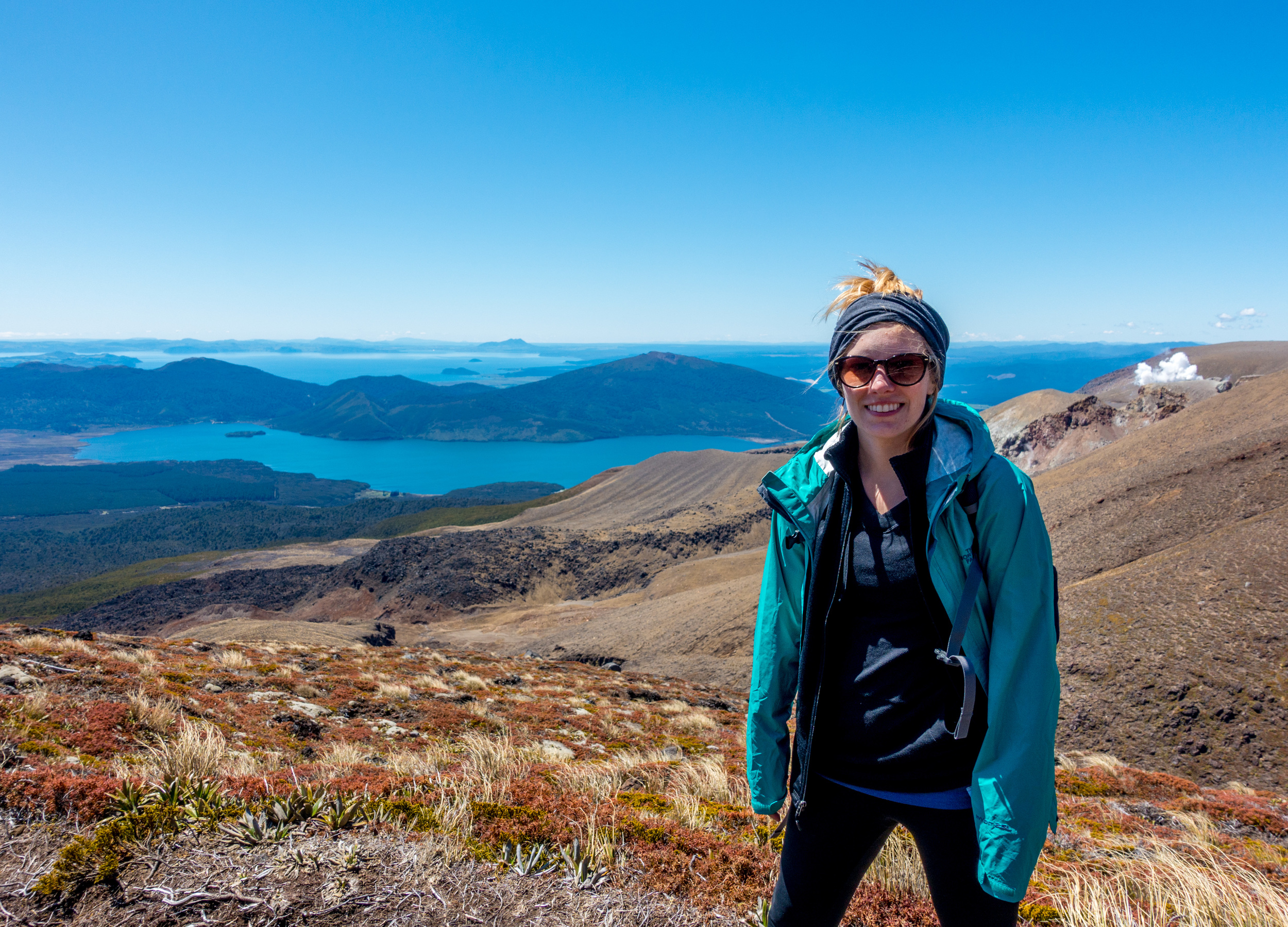
Another trek through snow brings us to creatively named Blue Lake, covered in broken ice. Soon you cross into "Active Volcano" territory and can see smoking fumeroles of the Te Maari crater as you hike around it. Te Maari was the site of Tongariro's most recent volcanic eruption in 2012. There are also great views of Lake Taupo, New Zealand's largest lake, as well as the carpark shimmering so far down below you. Still at least 2 hours to go.
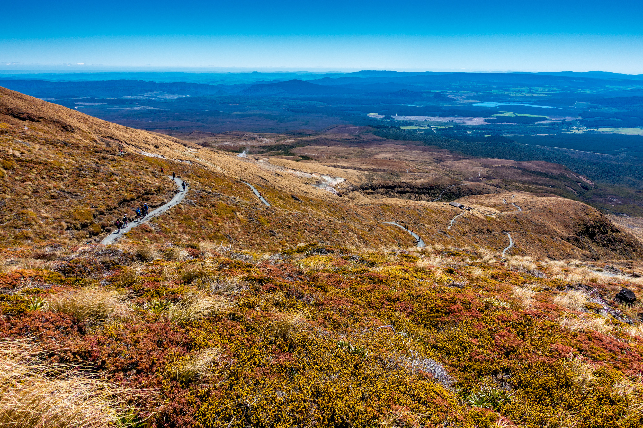
Once you reach the third bathroom, the track from there is all boardwalk, zigzagging down the steep mountainside, until the glorious last 30 minutes through the trees: shade!!
Looking back, I'm still thinking "I can't believe I just did that!!" I sure was happy to be done, but happy to have experienced it. Perhaps I don't have to call myself a "beginner hiker" anymore!
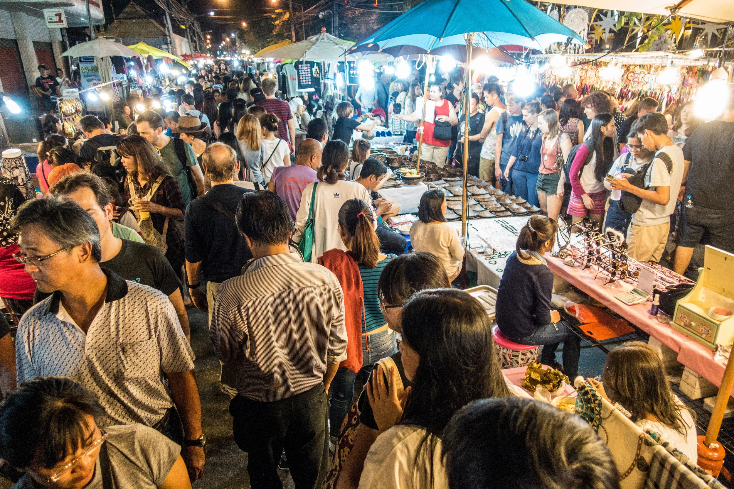


T-minus five hours to Myanmar. I awoke at 5AM after a night of fever dreams, having sweat through everything. I emptied the entire contents of my body, again, and ran a cold shower. Standing in the dark, near tears, I steadied myself against the glass wall and leaned into the water. The only rational thought I could muster was "Will this get better before it gets worse?"
I gently woke Emily and mumbled the dreaded words:
"I need to go to the hospital."